Extreme fog – Biting monkeys – Above the clouds and nauseous
N 29°34'08.5'' E 103°26'55.9''
Date:
31.03.2016 until 06.04.2016
Day: 277 – 283
Country:
China
Province:
Sichuan
Location:
Emeishan
Latitude N:
29°34’08.5”
Longitude E:
103°26’55.9”
Daily kilometers:
32 km + 120 km bus
Total kilometers:
16,256 km
Maximum height:
3.099 m
Total altitude meters:
(Only altitude meters covered by bike)
27.581 m
Sunrise:
06:57 a.m. – 06:50 a.m.
Sunset:
7:23 pm – 7:27 pm
Temperature day max:
20°C
Temperature day min:
2°C
(Photos of the diary entry can be found at the end of the text).
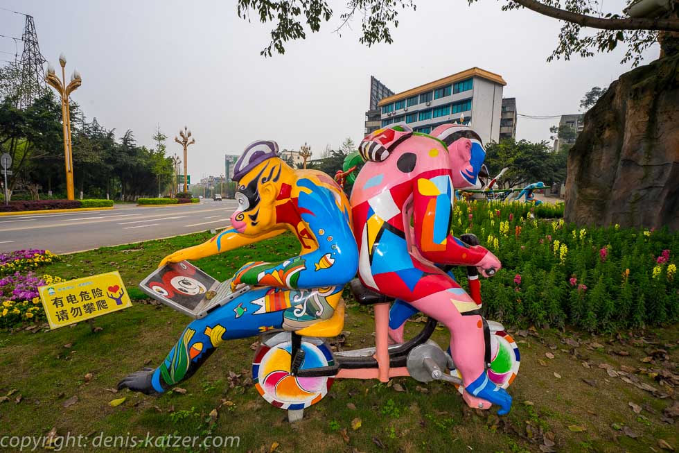
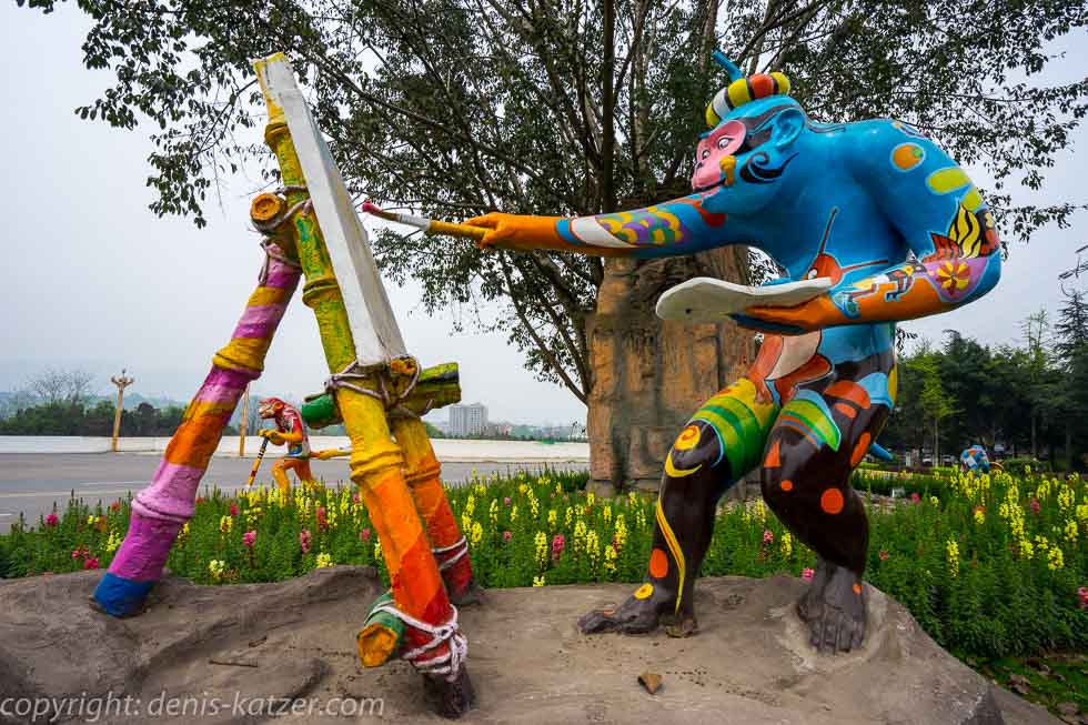
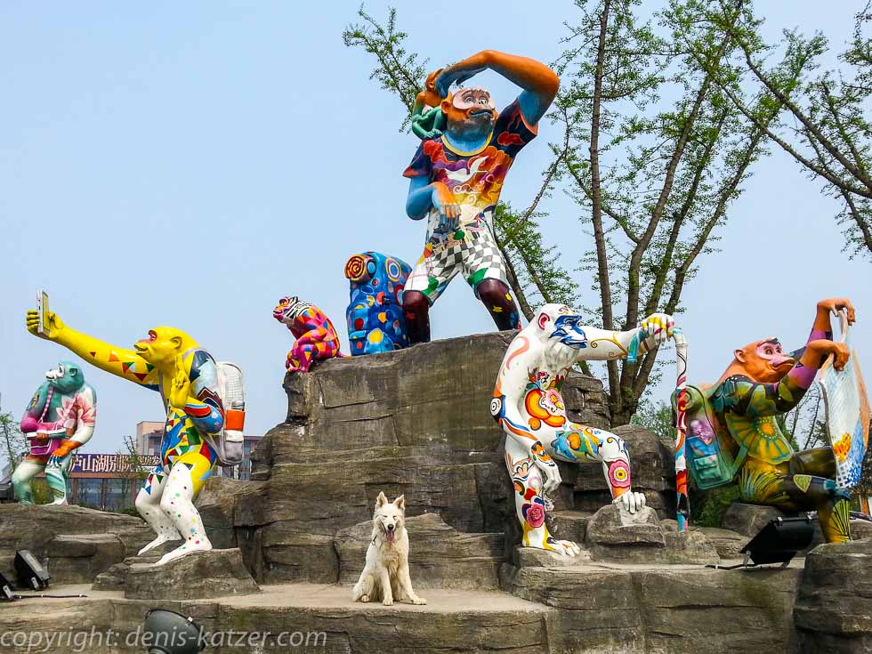
Back in Chengdu, we heard about Mount Emei Shan, which is one of the four sacred Buddhist mountains in China, was added to the UNESCO World Heritage List in 1996 and the temples built there are on the list of monuments of the People’s Republic of China. “You absolutely have to go there,” enthused Linda from the hostel in Chengdu, which is why we set off today and cycle west again. “Look, there are the first monkeys,” Tanja calls out with a laugh, pointing to a couple of oversized plastic monkeys who are having fun cycling, doing gymnastics and painting on a traffic island. As monkeys live on the Emei Shan, this animal seems to be a kind of mascot for the area, as we keep coming across monkeys designed by creative people hanging in the trees, studying maps and taking selfies along the way.
Without any experiences worth mentioning, we reach our accommodation today in a real tourist resort that is prepared to accommodate thousands and thousands of visitors. “They have to move out tomorrow,” we are told after we have dragged our equipment into the room. “How do you undress?” I ask. “Our guesthouse is fully booked from tomorrow. The next three days are public holidays,” we hear. “We’ve booked for at least two nights,” says Tanja, whereupon the girl at the small reception desk looks at the computer but can’t find us. “We still have a single room available in the backyard. It’s decidedly smaller. If that’s what you want…? But it costs twice as much as the big room you’re in at the moment because of the holidays and you’d have to book immediately,” she offers us with a smile.
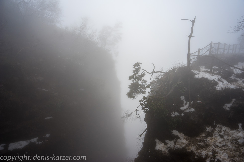
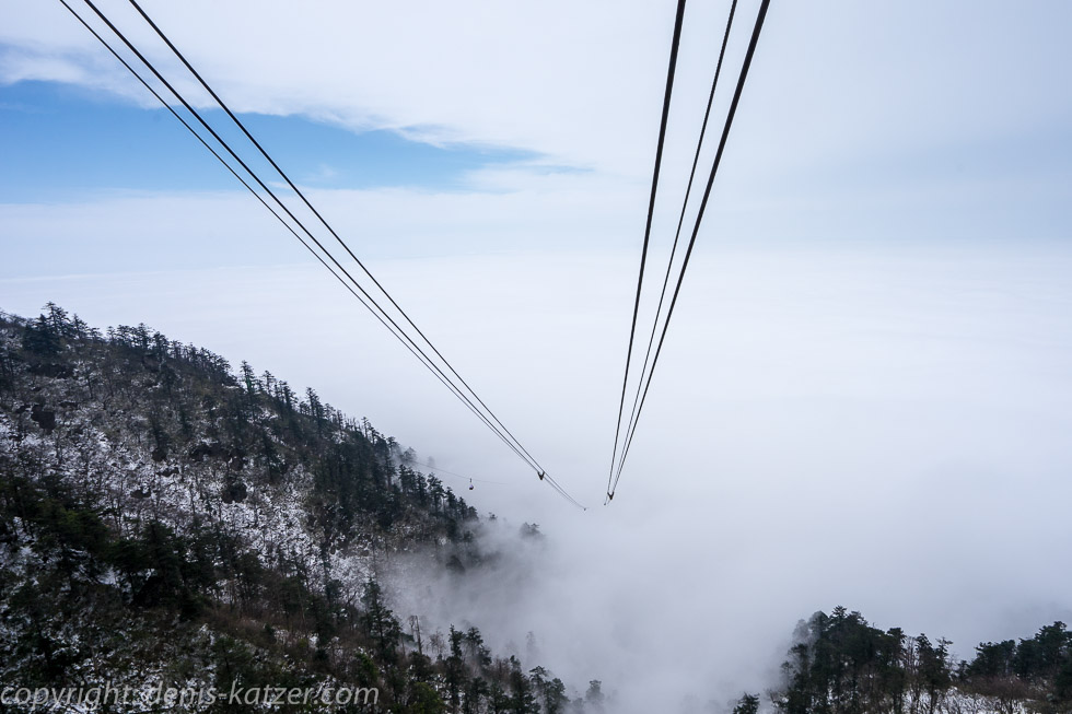
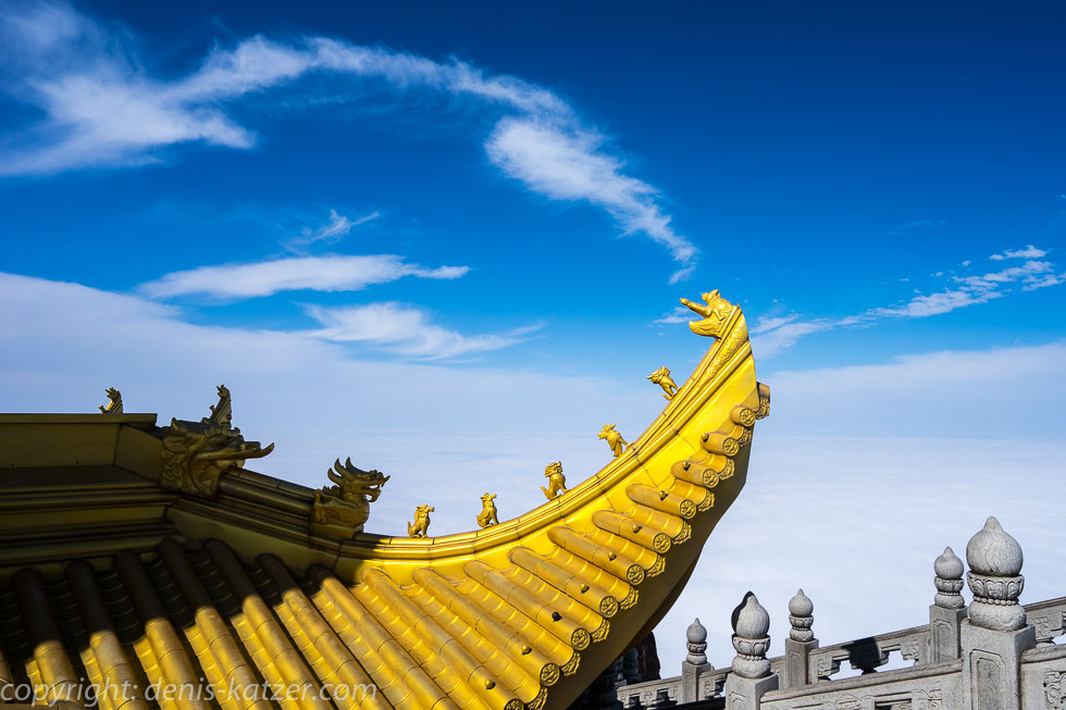
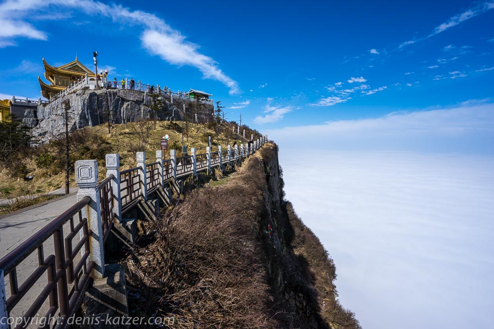
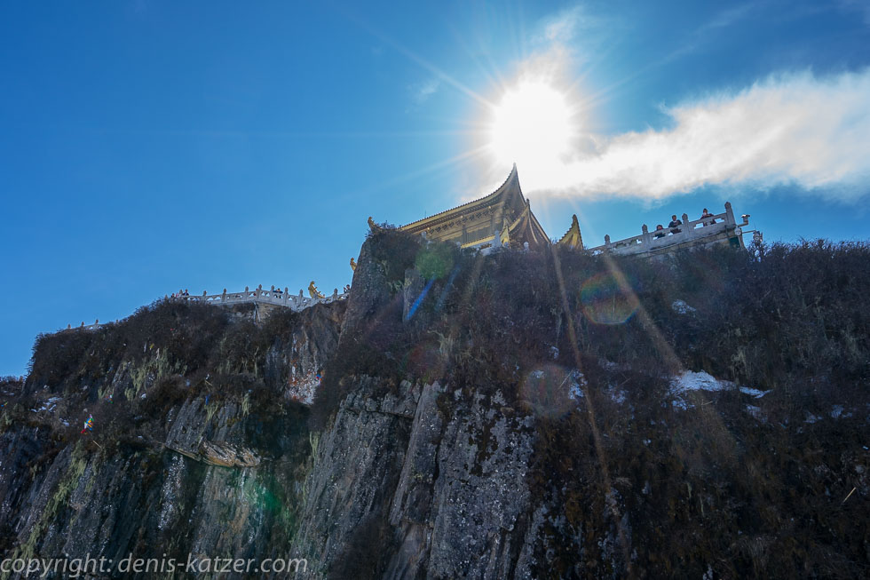
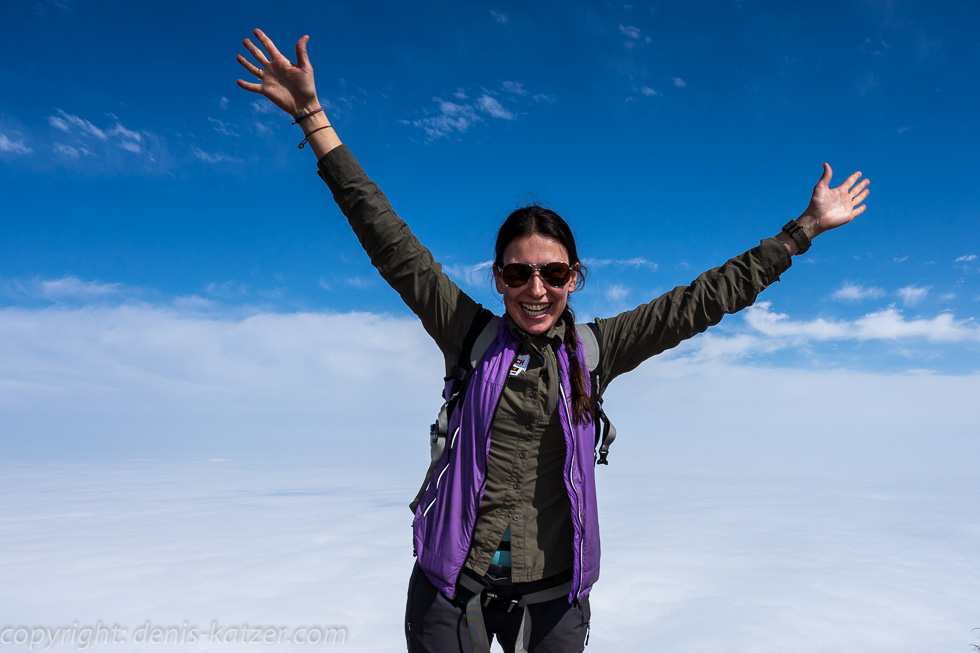
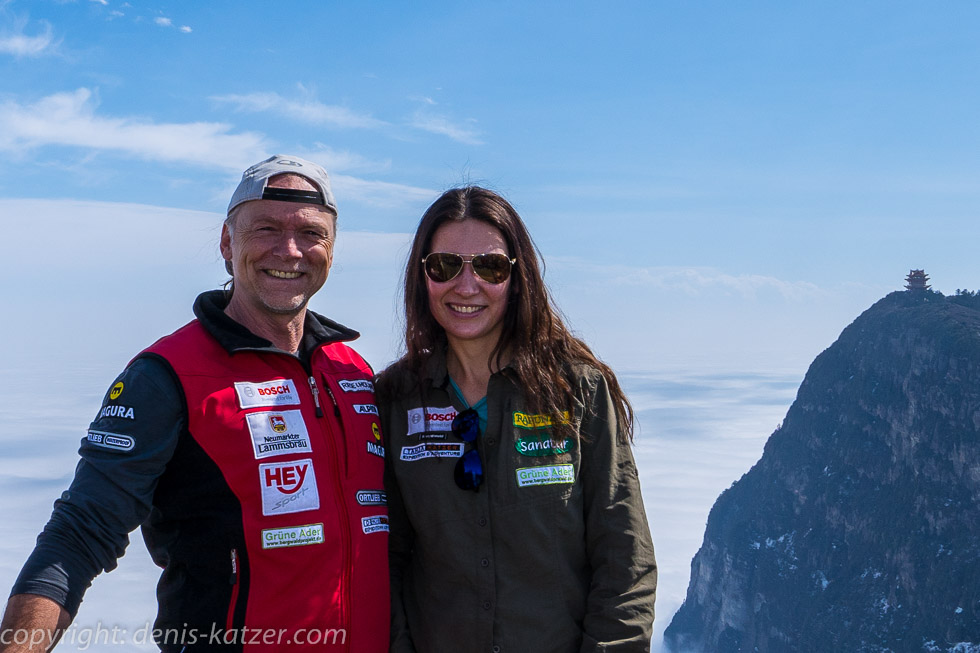
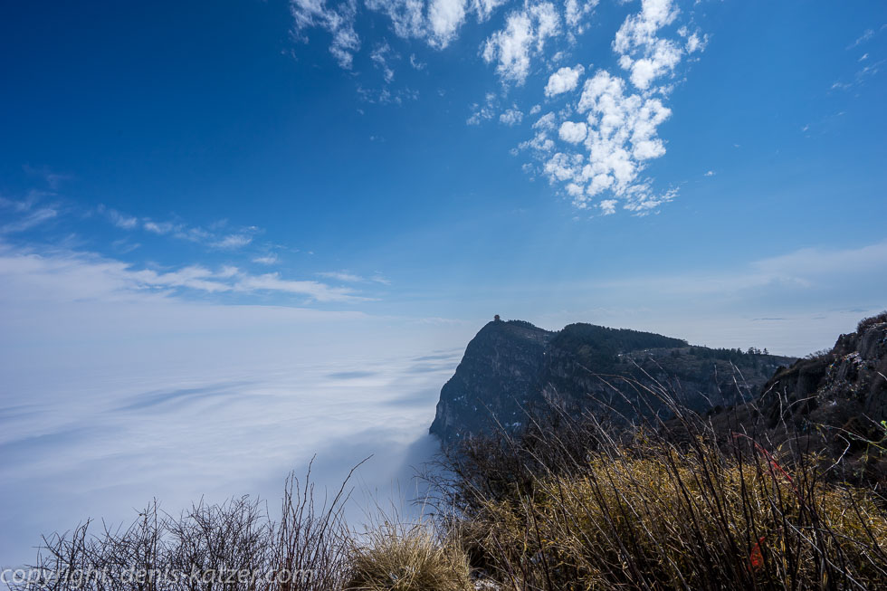
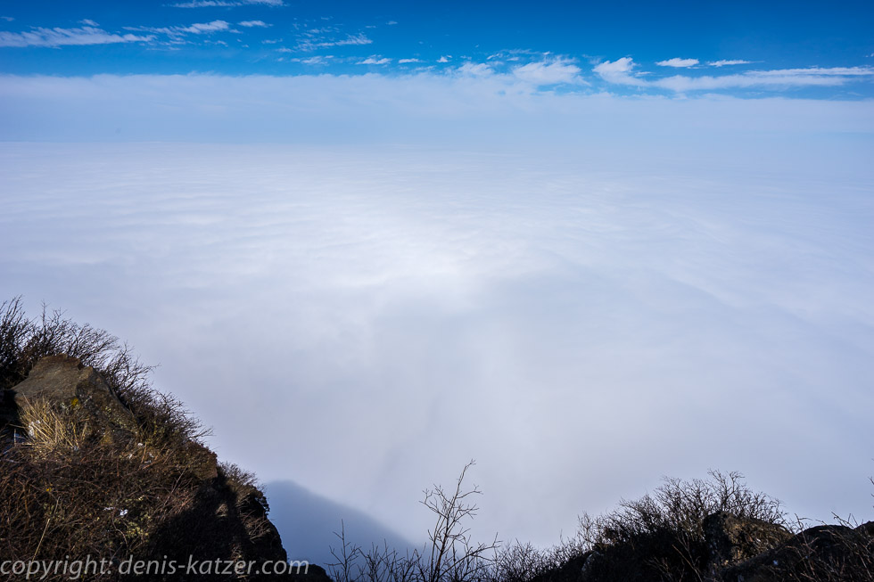
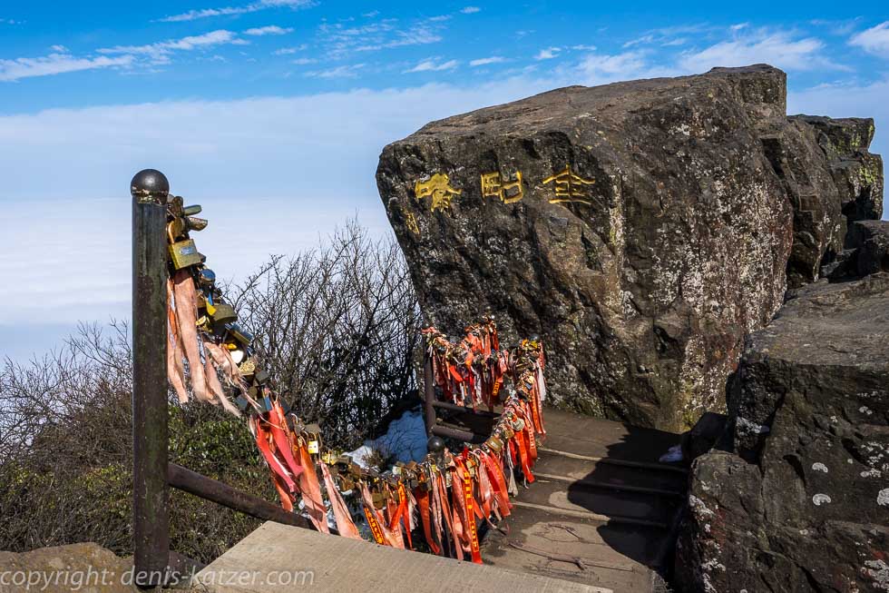
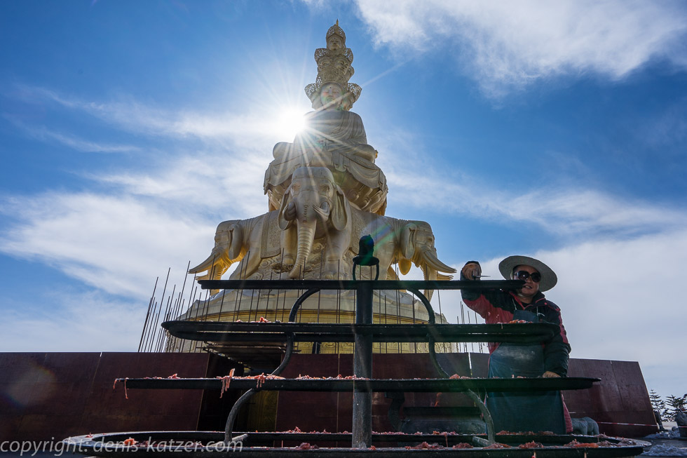
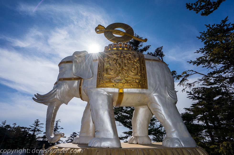
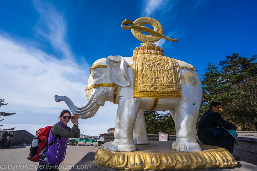
As the owners of the guesthouse seem rather greedy, we check out the next morning and move into a spacious room in another guesthouse next door for half the price. “All hell will break loose on the Emei Shan from tomorrow,” I think aloud. “And what are you trying to tell me?” asks Tanja. “What do you think about taking the bus to just below the summit today and walking the rest of the way up? If we set off straight away, we could do that and get to the mountain before the onslaught of thousands of Chinese tourists coming at the weekend. If we like it there, we can do the three-day hike the following day. It’s supposed to be strenuous, which is why we’re unlikely to meet many people.” “Hm, why not. So let’s pack our rucksacks quickly,” Tanja replies. 30 minutes have passed when we find ourselves in a small bus. It winds its way 50 kilometers over serpentines, hairpin bends and hairpin bends from 400 meters to an altitude of around 2,600 meters. The pancakes and two sandwiches that I had eagerly tucked into in the morning want to leave my body as quickly as possible. It takes a lot of persuasion to convince them not to do this. At an altitude of 1,700 meters, the bus is swallowed up by a thick wall of cloud. “Oh dear, if it looks like this at the summit, the trip will have been for nothing,” says Tanja. “If we’re lucky, the mountain peak will be above the clouds. That’s what the Emei Shan is known for,” I reply and hope that this will be the case today. Our vehicle stops in front of a barrier. We have to get off the bus and pay 180 yuan (€24.64) per person to enter the mountain in addition to the 90 yuan (€12.32) bus ride. “I can’t believe they charge admission for mountains in China,” I say, shaking my head. After two hours we reach a parking lot in the fog. Visibility is so limited that we can barely see 10 meters. Warning signs point out the dangers of the summit path. Snow and ice turn the surface into a slippery slope. “We should take the cable car,” Tanja suggests. I glance at my watch. “Hm, maybe you’re right. A hike wouldn’t be advisable under these circumstances,” I think. As if flying blind, we grope along and ask a few tourists who appear dimly in the fog for directions to the cable car. “Nali”, (There) they say, pointing into the white-gray, billowing wall. Again, we have to pay 120 yuan (€16.43) per person. A total of 107,- € to visit a mountain. “They’re crazy, the Chinese,” I get annoyed and pay. Due to the exceptionally bad weather, there are no people queuing at the cable car station. Halfway we pass a sign that says: One hour’s wait from here. “Man, we’re in luck. Imagine what’s going to happen tomorrow,” I say. We board the large gondola without any waiting time. We stand right by the window and look out into the clouds. After a short drive, it clears and, as if someone had flipped a switch, it suddenly becomes light at an altitude of 2,800 meters. “Ahhhh! Ohhhh!” shout the Chinese, clapping their hands and rejoicing like little children as we break through the wall of clouds and it lies beneath us like a sheep’s wool carpet. Smartphones are suddenly in full operation. Everyone wants to have a picture of the phenomenon. It doesn’t take long before we reach the 3,099-metre summit. Although it is not cold due to the pleasantly warming sunshine, there is snow and ice on some paths. We walk past countless food stalls and sales booths. Then wide steps provide a view of a 48-meter-high statue depicting Samantabhadra, an all-encompassing good being of wisdom and goodness. It is made of gold-plated copper and is considered one of the largest golden Buddha statues in the world. Visitors and worshippers offer candles on a huge stand. We enjoy the atmosphere and climb the steps to the top to admire the Jinding Temple, which stands on the golden peak and dates back to the Tang Dynasty (618 to 907). “It’s crazy how they hauled all the building materials up to 3099 meters to create buildings like this. Somehow it reminds me of the saying, ‘Faith moves mountains’,” I marvel at the golden splendor that, one might think, was erected on the white clouds. Just a few meters further on, we are amazed again when we discover the famous Eyebrow Mountain, which got its name because of its elongated shape. At its top, a small temple hovers above the white cloud cover. “Just like on the postcards. The view alone was worth coming up here,” says Tanja enthusiastically. We follow a path whose side facing the edge of the mountain is bordered by a massive fence. “Wow!”, I exclaim as my gaze follows a vertically plunging rock face that disappears into the endless sea of clouds about 300 meters below us. The wafting edges of the white cloud cover resemble the moving fingers of a ghost and give the impression that they are reaching for the bare rock to slowly shimmy their way up to us. “Fascinating,” says Tanja pensively. “The ocean of impenetrable clouds makes you think you can walk on it.” We take a few photos and are mesmerized by the breathtaking view. On some days, rainbow-like reflections shimmer in the cloud cover. Some Buddhists saw this natural phenomenon as the gateway to the Pure Land, which prompted many people to jump in. During the Ming dynasty (1368 to 1644), a barrier was built to protect the believers. (Pure Land is the idea of a realm of existence in which the continuous cycle of rebirth, of becoming and being, has ended, in which all conditions for spiritual practice are considered favorable for the attainment of Buddhahood and great spiritual merit can be accumulated).
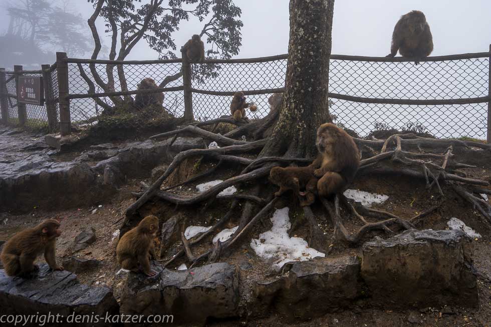
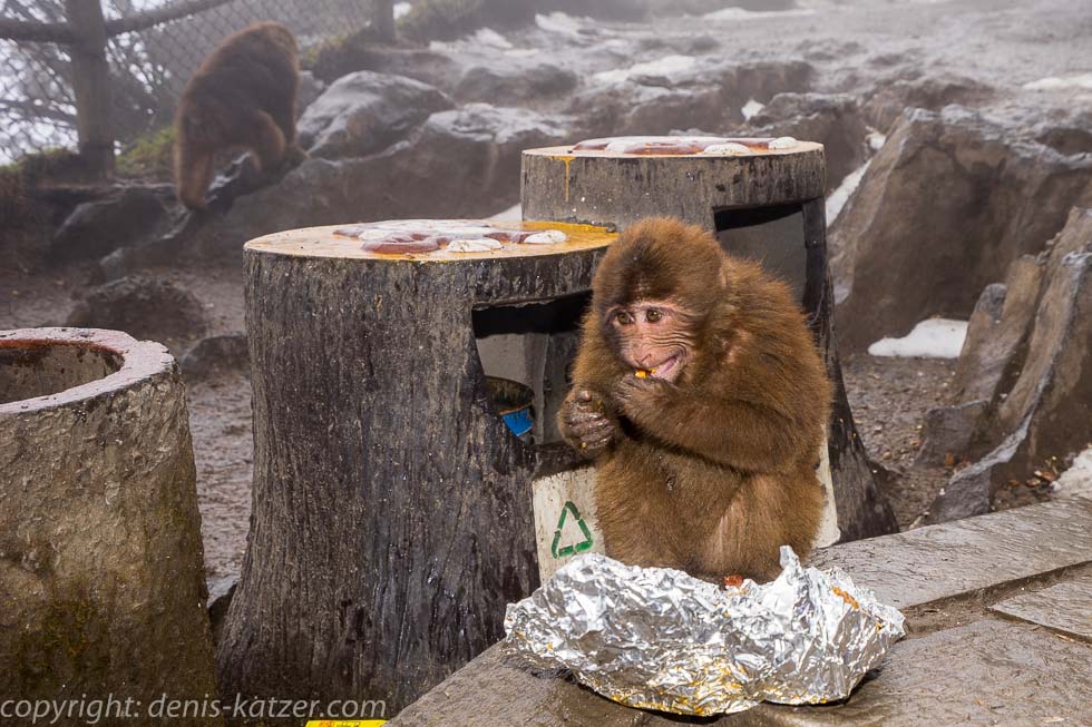
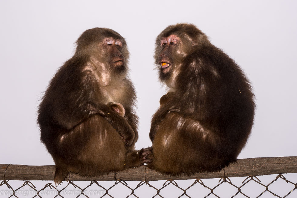
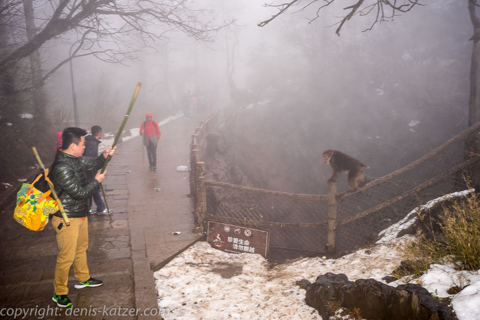
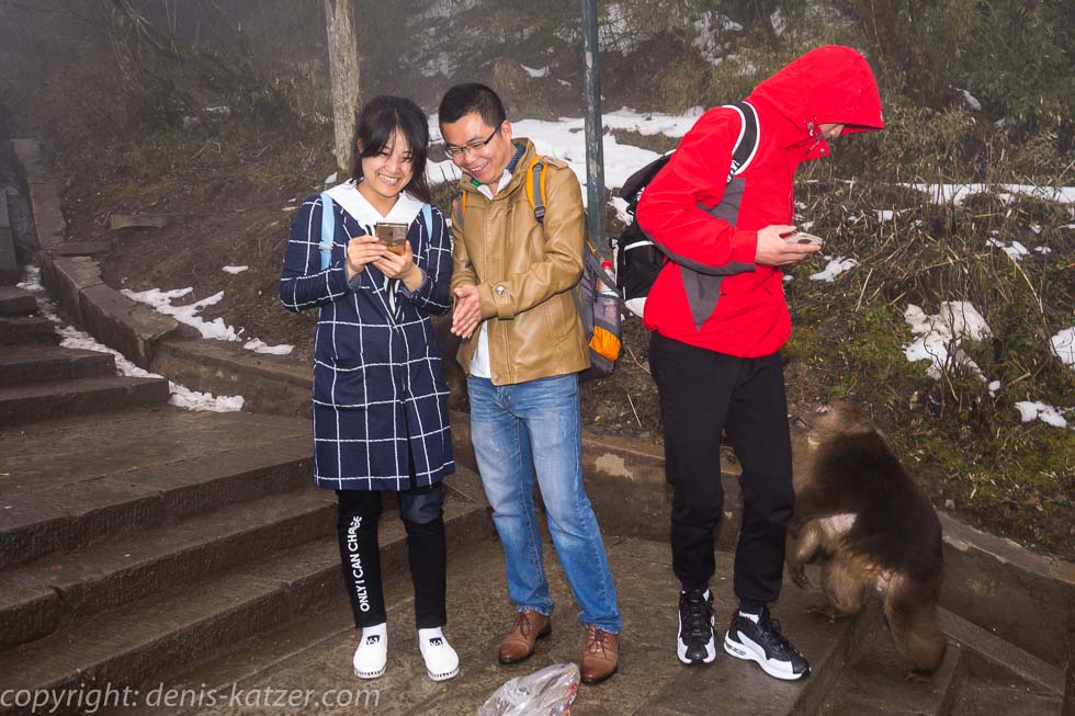
In order to catch the last cable car, and above all the bus down to the valley, we leave this sublime place, although we would like to stay longer. On the way down, the dense wall of cloud sucks us in again. As if our experience on the summit had only been a dream, the mountain world is shrouded in wet fog. Suddenly the monkeys appear, who live up here in large numbers and demand something to eat from the tourists. Two young Chinese women walking directly in front of us are attacked in a flash by one of the Tibetan macaques. “Iiiiiihhhhhhh!”, the two scream, completely terrified, while the aggressive robber steals a plastic bag full of food from them. Unable to do anything else, I jump in between them, let my walking stick whiz through the air, whereupon the monkey drops the bag, hissing angrily, and retreats a meter. The two girls look at me, frozen. “Take it! Take your bag!” I shout. Suddenly they laugh shyly and pick up their bag again. “Xie xie,” they say in thanks as the monkey dares to attack a second time. “Get lost and leave the girls in peace!” I shout at him. Snarling like an evil dragon, he retreats. “Xie xie,” the two young women thank me again and hurry off. Another of the Tibetan macaques, who looks like the leader of the troop because of his muscular body, leaps at a Chinese man who stumbles because of the weight of the wild animal. Fortunately, the man is able to stay on his feet. The hairy leader clutches the man’s hips with his powerful hind legs and now looks like an ape on human legs. Conscious of his powerful charisma, he calmly takes the bag from the man’s hand and disappears. As the wild mountain dwellers are known to bite the odd human in an emergency, it is certainly better not to irritate them. Especially because their bite is very painful and can also transmit rabies. We linger here for a short time and observe how the monkey gangs, just like the highwaymen and robber gangs of the European Middle Ages, attack defenceless passers-by by the dozen. They show their long teeth to a few men who know how to defend themselves with their walking sticks. It clearly depends on who has the greater macho charisma. In the end, the wiser gives in and sometimes the wiser is a monkey.
We catch one of the last buses. This time we can’t find a seat in the front row. Full of curiosity to see how my pictures have turned out, I unpack the camera to look at them on the display. A mistake. A big mistake. The bus has barely set off and is winding its way around the first hairpin bends when I look up. Apart from fog, nothing is recognizable. I lose my bearings for a moment and suddenly feel sick. “It was a great day,” says Tanja enthusiastically. “Please don’t speak. I feel terribly sick,” I reply, now looking frantically out of the window. For two hours, the route runs incessantly from left to right, from hairpin bend to hairpin bend, from S-curve to S-curve and from hairpin bend to hairpin bend. When we reach the bottom of the valley, my face is green. I managed not to throw up but I’m cured of bus travel for now. I still don’t feel well the next day. Only the sound of a bus engine makes my hair stand on end. I refrain from hiking up the 3099 m high mountain and use the time to write down our experiences…
If you would like to find out more about our adventures, you can find our books under this link.
The live coverage is supported by the companies Gesat GmbH: www.gesat.com and roda computer GmbH http://roda-computer.com/ The satellite telephone Explorer 300 from Gesat and the rugged notebook Pegasus RP9 from Roda are the pillars of the transmission.