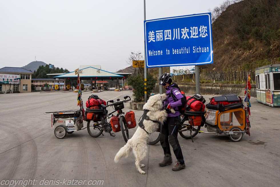
Welcome to beautiful Sichuan
N 32°23'10.1'' E 105°38'17.6''
Date:
23.02.2016 until 24.02.2016
Day: 239 – 240
Country:
China
Province:
Sichuan
Location:
Baolunzhen
Latitude N:
32°23’10.1”
Longitude E:
105°38’17.6”
Daily kilometers:
108 km
Total kilometers:
12,529 km
As the crow flies:
76.13 km
Average speed:
20.2 km/h
Maximum speed:
54.7 km/h
Travel time:
5:12 hrs.
Soil condition:
Asphalt / gravel
Maximum height:
1.000 m
Total altitude meters:
22.792 m
Altitude meters for the day:
820 m
Sunrise:
07:33 a.m. – 07:32 a.m.
Sunset:
6:48 pm – 6:49 pm
Temperature day max:
8°C
Temperature day min:
7°C
Departure:
09:30 a.m.
Arrival time:
4:30 pm
(Photos of the diary entry can be found at the end of the text).
On the way to the town of Baolunzhen, we continue to cross gentle mountain ranges. China’s many mountains seem endless. Its mountains grow into each other like two hands folded in prayer. I have given up hoping for longer flat stretches. This evening our GPS computer will have calculated over 800 meters of altitude that we will cycle this day. A mere 1,700 meters in altitude, which we also climbed on a 123-kilometre day.
A wonderful cycle path suddenly appears next to the busy G108 main road. We can hardly believe our eyes. New small signs indicate gradients, dangers and distances. “And that in the mountains of China,” I say happily, leaving the main traffic lanes. From now on, the wonderful, reddish-colored bitumen strip leads us through a small village without any traffic. It gives us the wonderful and safe feeling of being on a German cycle path. Tunnels built especially for cyclists lead us under the main road to the other side. Above us, vehicles thunder along the G5 highway and a wide mountain river rushes through its bed beside us. “Wonderful!”, I cheer, even though there are suddenly lots of small stones littering the path and demanding our attention. That should have been a sign, especially that we have been the only ones on this path for at least 5 km. “Is that as far as it goes?” I shout as I think I recognize a pile of rubble. Someone has actually dredged a huge mountain of stones and sand onto the beautiful cycle path. Behind it is a dense wooden fence that makes any progress impossible. “I’ll have a look,” I say to Tanja, because I don’t want to put up with such a ridiculous barrier. However, the massive plank wall leads so close to the abyss that we would have to push past it with the risk of falling into the deep gorge. “No chance,” I say disappointedly, which is why we have to cycle back the 10 km we’ve already covered on the cycle path. Detours of this kind seem to have been on the daily agenda for some time now, which is why I’m no longer too annoyed about them. Who can expect the Chinese to build a fantastic cycle path and not point out that they have filled it with rubble?
Suddenly the wide road is closed by a toll station. Fortunately, this time it’s not a highway, but the border to Sichuan province. Signs greet us with “Welcome to beautiful Sichuan” After 3 ½ months in Shaanxi province, we finally enter Sichuan province, which lies to the east of the Tibetan plateau on the upper reaches of the Yangtze River. The Yangtze River, which divides the country into North and South China, is the longest river in Asia at 6,380 kilometers and the third longest river in the world after the Nile and the Amazon. I am looking forward to visiting this historic and important waterway during our trip. But there are still many mountains ahead of us, as western Sichuan is dominated by the Daxue Shan, a high mountain range whose highest peak is the Gongga Shan at 7,556 meters. In the north, the province is bordered by the Qinling Mountains, which are up to 4,000 m high and whose mountain ranges we have been crossing again and again for almost 1,600 km and three months. The route to the south is dominated by the Dalou Mountains, which are up to 2,000 m high. On our journey to Vietnam, this definitely means that we will have to continue driving over mountain ranges without any interruptions.
However, the core of the province, in which 95% Han Chinese live, lies in a fertile basin with a subtropical climate. For us, this means that we no longer have to reckon with extreme cold and frost. We will only know what the temperatures are like in the higher mountain regions inhabited by minorities such as the Yi, Tibetans and Miao when we cross them. Otherwise, the average temperature in January is around 8 °C. So perfect for us cyclists.
“We’ve already made it this far,” Tanja says happily, looking at the welcome sign. “Yes, it’s a long way when you consider that we started with the bikes in Germany many years ago,” I say, standing next to her. “I wonder what awaits us in this province?” “Hm, in any case, Sichuan has an ancient culture whose first written documents date back to the 18th century BC. But it’s probably much, much older.” “And what do you mean by that?” asks Tanja. “I think countries that have such an ancient history are always interesting, no matter what is left of it today or not. There are certainly endless historical sites, temples and buildings to visit here, most likely more than our time allows. From what I’ve read, the landscape must be stunning and impressive. I would love to cycle further west from here to Tibet. Just like we did 20 years ago when we traveled across the roof of the world to Nepal. Only this time with our e-bikes,” I reply. “We decided to go to Vietnam, Cambodia and Laos on this stage. That’s certainly exciting too,” Tanja replies. “No question, maybe we can take a little detour through the west after Chengdu. Hopefully we’ll also come into contact with the Tibetan people there and catch a glimpse of the high valleys, highland terraces and mist-covered glacier mountains.” “You can’t get enough of all these mountains, can you?” “Actually, yes, but it’s damn interesting in these mountain regions, don’t you think?” “Right, so off to Chengdu, a bit west and then to Vietnam,” Tanja replies in a good mood.
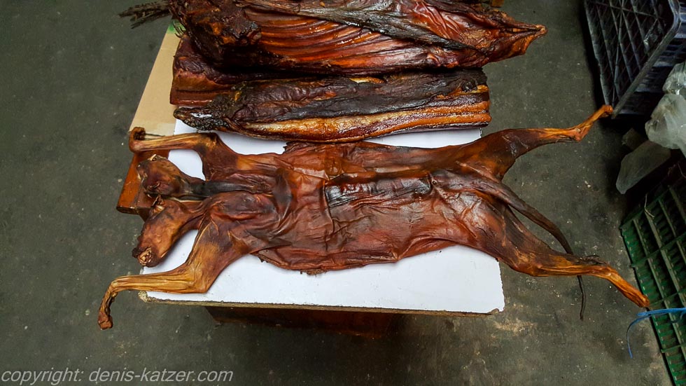
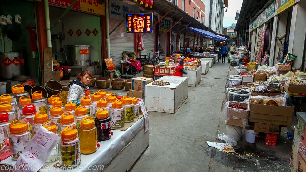
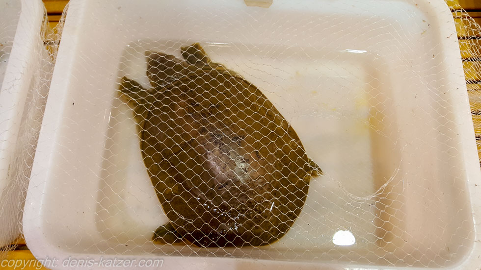
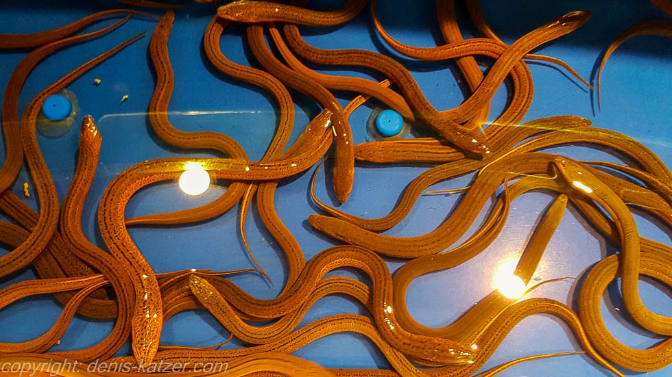
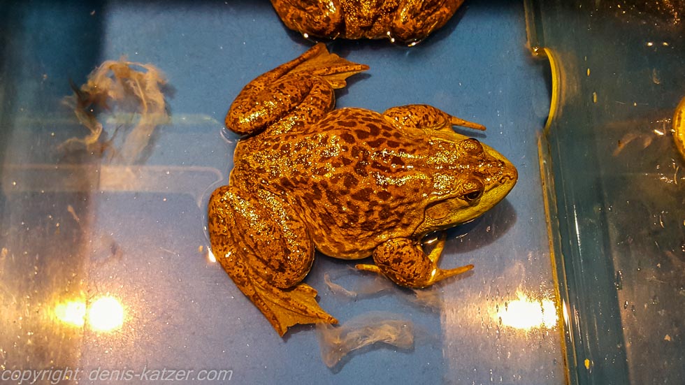
After 108 kilometers we reach the small town of Baolunzhen. After storing our belongings in a shabby shed, we go to the market to buy fresh fruit and vegetables. We also walk through an area where live fish of all kinds gasp for air in small tanks, live turtles wait to land in a wok and hundreds and hundreds of naked chicken feet lie in crates. “You have to see this,” I say to Tanja, standing in front of a smoked animal lying on a white wooden board and offered for sale. “Is that a cat?” asks Tanja, shaking her head in horror. “I don’t know,” I reply, taking a closer look at the former creature. “Looks more like a small dog. Cats have pointier teeth.” “Come on, let’s move on quickly. It’s terrible what humans eat. I’m really glad to be a vegetarian”…
If you would like to find out more about our adventures, you can find our books under this link.
The live coverage is supported by the companies Gesat GmbH: www.gesat.com and roda computer GmbH http://roda-computer.com/ The satellite telephone Explorer 300 from Gesat and the rugged notebook Pegasus RP9 from Roda are the pillars of the transmission.