The most famous pass road in Norway – Trollstigen
N 62°27.07.5'' E 007°39'46.6''
Date:
19.09.2020
Day: 048
Country:
Norway
Location:
Trollstigen
Daily kilometers:
185 km
Total kilometers:
3893 km
Soil condition:
Asphalt
Ferry
1
Bridge crossings:
7
Tunnel passages:
1
Sunrise:
06:59 a.m.
Sunset:
7:47 pm
Temperature day max:
17°
Night temperature min:
02°
Departure:
12:00
Arrival time:
18:00
(Photos of the diary entry can be found at the end of the text).
Click here for the podcasts!
Link to the current itinerary
(For more posts click on one of the flags in the map)
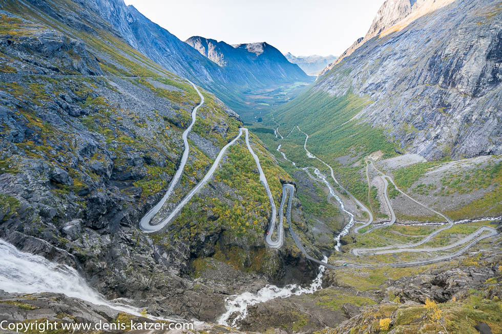
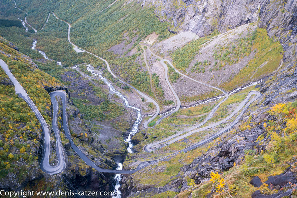
The Terra follows the winding mountain road, which runs at an altitude of up to 850 meters through a golden autumn landscape whose beauty, loveliness and splendour are difficult to describe in words. As if we were the main characters in a panoramic movie, impressive mountain ranges and peaks glide past our windows. The 1,450 meter high Bispen (Bishop), the 1,614 meter high Kongen (King) and the 1,701 meter high Dronninga (Queen) are just a few of the mountains that have been given names. “As fantastic as it looks here now, it must be so hard in winter,” says Tanja, looking out of the window. “I think the route is only open from mid-May to the end of September. I think it’s completely impassable in winter because of the huge amounts of snow,” I reply. If we hadn’t set our minds on photographing one of Norway’s most famous and interesting pass roads in the evening light today, we would have taken more time here. On the last 20 kilometers before our destination, the sun says goodbye behind the high mountains. “Shit,” I curse. “Oh Denis, we don’t know what that’s good for,” I hear Tanja’s reply. “You mean, if we had arrived earlier, we might have been hit by a rockfall or we would have gone off the road while steering into one of the hairpin bends because a rabbit would have hopped across the road at that very moment that I was trying to avoid?” “Who knows. You shouldn’t take it so ironically. Over the last few decades, we’ve often found that when things go differently than planned, they turn out well in the end.” “You’re right, of course. But it’s also human to just swear and let out your anger.” “If you don’t get stuck in anger, that’s certainly okay,” Tanja replies well-meaningly.
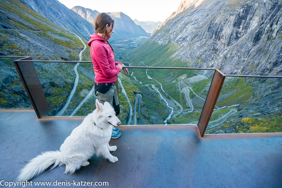
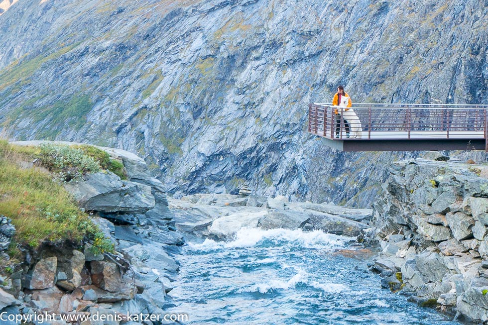
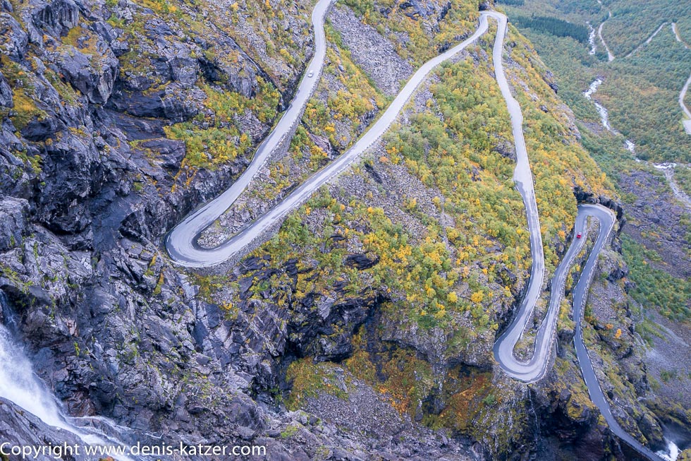
We reach the large parking lot at the top of the Trollstigen (Troll Ladder), put on a jacket and leave the Terra. “There’s one of the viewing platforms up ahead!” I shout and hurry off as I catch a few rays of sun above the mountain peaks. Another “wow” crosses our lips as we look down into the valley wedged between mountain ridges, through which the mountain road meanders and winds its way up to us over eleven hairpin bends. “So this is it, the famous Trollstigen, Norway’s best-known route,” I say. “Isn’t it also called Adlerstrasse?” “Yes.” “A fitting name for such a building. Nevertheless, I somehow imagined Trollstigen to be different,” says Tanja. “Yes, me too,” I reply as Nils, Arne’s brother, who we were staying with in Bergen, has sent us a photo showing many more bends winding even tighter upwards. “That must be a different street in the photo,” Tanja notes. “Definitely, because the valley in the photo was a fjord and here it’s a dry valley.” “It doesn’t matter, it still looks impressive,” says Tanja. “It’s amazing what people can build. Especially when you consider that this engineering feat was built between 1936 and 1939 and opened to traffic by King Haakon VII,” I say after a few minutes of amazement, breaking our silence. “And back then, they didn’t have any modern machines to make their work easier,” adds Tanja. “No, they used to do everything with their bare hands. It was gruesome work, having to dig into the hard rock face like that. I don’t want to know how many workers lost their lives in the process.” “Do you think Adlerstrasse looked like this back then?” “I think so, except that at that time it was a simple gravel road that none of today’s travelers would have dared to cross in a motorhome. However, the authorities had the road paved in 2000 due to the ever-increasing number of tourists (around eight hundred thousand visitors a year were expected in 2019).” “So it looks different today.” “According to my research, they tried to keep the look, but spent a lot of money on securing the route.” “Well, that reassures me. I’m curious to see how we’ll fare tomorrow when we drive down into the valley along the often single-lane asphalt strip along the steep rock faces, chasms and waterfalls. It’s a mixture of thrills and fascination. Don’t you think?” “Well, I wouldn’t say thrill, but it’s definitely fascinating,” I reply as we leave the viewing platform only to enter another one from where we can see the Adlerstrasse from a new perspective.
On the way to our Terra, we decide to hike into the mountains tomorrow to photograph the Eagle Road from the opposite side. Then we want to reach the valley via the Trollstigen to continue our journey towards the North Cape. “Another great day,” I say. “Fantastic. I’m looking forward to tomorrow.” “If I had a delicious Franconian beer now, it would be the perfect end to the day.” “You could leave out the beer.” “That’s true, but even a bad beer is better than no beer.” “Well, don’t complain then.” “Hmmm…”