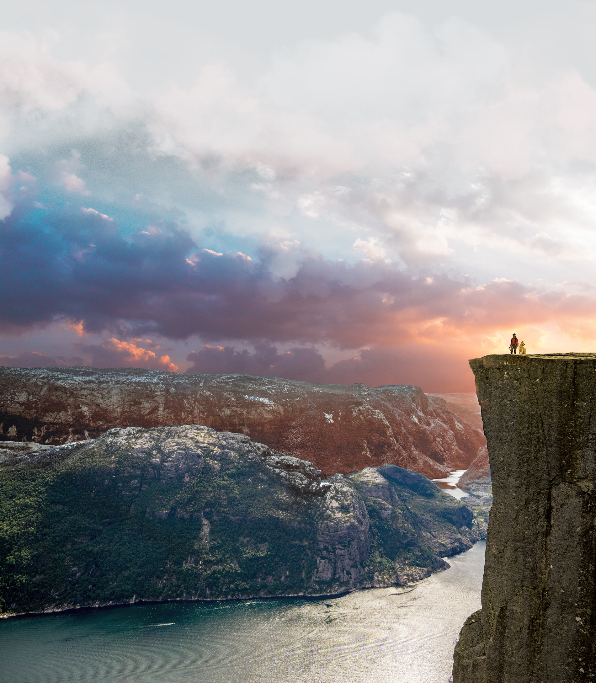
No way through the maze of fences without a map

Day: 244 Stage three / total expedition days 635
Sunrise:
05:28
Sunset:
18:53
As the crow flies:
22,6
Daily kilometers:
40
Total kilometers:
6727 km
Temperature - Day (maximum):
39° degrees, sun approx. 60°
Temperature - Night:
21° degrees
Tickets Loss Camp – 15.01.2003
At Springton Creek, large trees provide us with pleasant shade. We wind our way through the river system and reach the Springton Homestead. “I’ll show you the way to the old cane route,” says the old man of the station and takes me on an exploratory trip. “This is the end of our country. It’s best to follow the fence here until you reach our neighbors. I’m sure he can tell you how to find the rest of the old cattle route from there,” he says and takes me back to Tanja and the camels.
“The old route goes over the hills over there. I’ll draw you a map of how to get there,” says Bill from Mourindilla Station.
The path is barely visible until we reach the hills. A rocky path was blasted into the mountain here a long time ago. Tall trees and bushes arch over our heads. The air is hot and humid. Rays of sunlight flash through the dried-out branches. Slowly, our caravan makes its way over the steep, brittle rocks. It’s fantastic to see the performance of our boys. The 24 camel feet carefully find a safe foothold. To our left and right, we discover many old tree stumps. They are remnants that tell of how hard people had to work here with axes, shovels and picks in pioneer times to build a path through this wilderness with their bare hands. It is hard to imagine how large covered wagons with their huge wooden wheels once bumped over the rough ground here. Large teams of six, eight or more horses pulled these huge, heavy wagons through the outback to bring important goods to the remote farms.
The landscape around us is completely scorched by the sun. The lost cry of a bird reaches our ears. In some places, a fallen tree trunk gets in the way. We are forced to go around it through the dense undergrowth. Meter by meter, we continue to work our way over the stony hills. Because it’s so terribly dry, we can’t find a place to camp. The hours pass. “There’s no point in walking any further. I think we should find somewhere here to spend the night,’ I break the silence. “Whatever you say,” Tanja replies, exhausted. In a light forest flooded by the merciless sun, I give the tired camels a shower. Once again they put up a brave fight and took us 40 kilometers today without complaining. I’m just starting to unload Sebastian’s saddle when I get a boiling hot shock. “My God! Where’s the map?” I ask out loud. “What do you mean?” Tanja replies wearily. “Well, our map. It was always tied to Sebastian’s saddle. I can’t believe it. It’s gone!” I shout, beside myself. “Maybe it’s under the equipment that’s already been unloaded?” says Tanja. I immediately rummage through everything, but I can’t find them. “She’s gone! We’ve lost it. We can’t find our way out of the maze of fences without a map. Besides, I don’t know where the ford across the Mackenzie and Fitzroy Rivers is. What a mess. Now I have to walk back until I find it,’ I grumble. “Let’s unload first and then discuss our next steps,” Tanja replies. “Okay,” I say and start to heave the rest of the equipment out of the saddlebags, scowling.
30 minutes later we are sitting under our protective foil and discussing what we should do to get the important map sheet back. “Maybe you should call Rona from Cooroorah Station on the satellite phone. She can then inform her friends, who in turn can contact Bill from Mourindilla Station.” “And you mean Bill sets off on a search and manages to make his way over the rocky hills? No jeep can get through there. Have you forgotten about the trees lying across?” I reply thoughtfully. “Maybe I should walk back first thing in the morning. It’s about 2 ½ hours to Mourindilla. It would take me a maximum of five hours there and back,’ I add rather despondently. “But that would mean having to stay here a day longer. Our boys would have to starve,” Tanja interjects, to which I look at the dry surroundings. “Okay, I’ll call Rona,” I decide. The satellite phone rings shortly after my call. “Denis?” “Yes.” “Bill will go and find the map right away. He remembers you using it to ask him for directions. He’ll look you up today,” says Marcia Edmingtone, who initiated the search.
It’s just before sunset when we hear the sound of engines getting louder and louder. “That must be Bill. He actually seems to have found a way around the tree trunks.” I say in amazement. Moments later, he gets off his small off-road vehicle, which the Australians call a four-wheeler. It is nothing more than a kind of off-road motorcycle with four wheels. “Hello, good to see you. Did you find her?” I ask. Bill laughs at me, reaches back with one hand and pulls out the card. “She was lying at the crossroads where you turned off onto the old route. I thought I’d look for it today, because it could easily have been found by dingoes. As you probably know, wild dogs are very curious. They would have dragged the map with them and most likely tried to eat it,’ he says with a laugh. “Thank you very much,” I reply, relieved to receive the important navigation aid.