Inhabited since the Stone Age – Vesterålen archipelago
N 69°19'28.8" E 16°07'05.7"
Date:
01.10.2020
Day: 060
Country:
Norway
Location:
Andenes
Daily kilometers:
232 km
Total kilometers:
5444 km
Soil condition:
Asphalt
Ferry
0
Bridge crossings:
13
Tunnel passages:
10
Sunrise:
07:04
Sunset:
18:39
Temperature day max:
14°
Night temperature min:
9°
Departure:
11:30
Arrival time:
17:00
(Photos of the diary entry can be found at the end of the text).
Click here for the podcasts!
Link to the current itinerary
(For more posts click on one of the flags in the map)
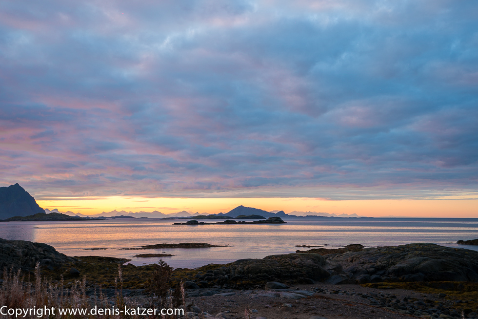
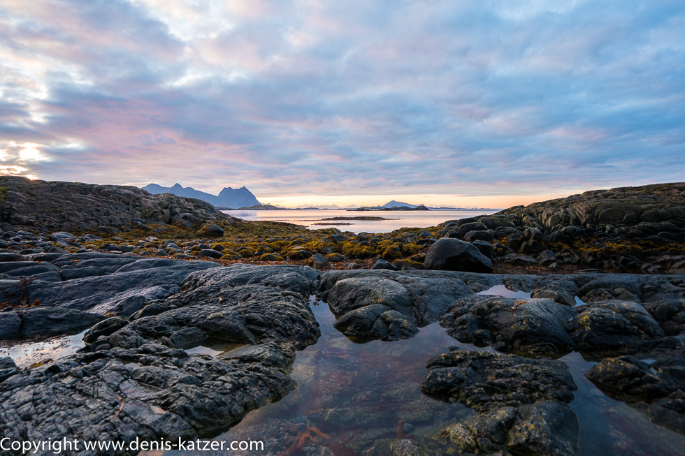
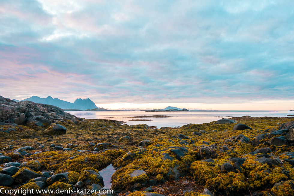
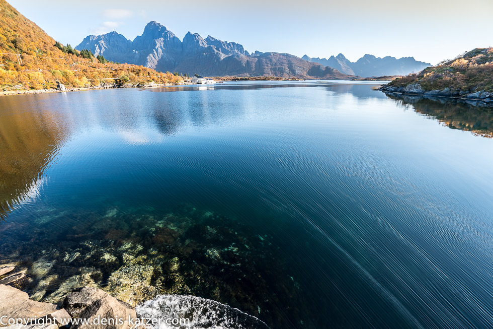
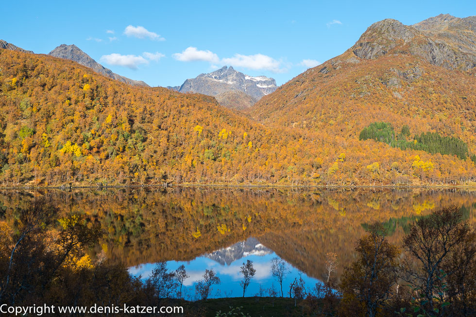
I look out of the window of our Terra Love. Low-lying blue-rosy clouds stretch across an expansive bay. Far to the west on the horizon, the jagged band of a mountain range is visible, ducking under the colorful band of clouds and glowing a light orange in the gentle rays of the sun. With each passing minute, the sun star climbs towards our side of the globe, the sun’s rays grow stronger and stronger and suddenly make the background of the mountain silhouette glow a vibrant orange. As soon as they have managed to conquer the distant peaks, they illuminate the wide expanse of water, which looks like a polished mirror in the completely windless morning. Reflections of light hit our Terra Love and, moments later, the mountain ridge behind us, with autumn-colored deciduous trees lining its base. From the point where the trees cannot find a foothold in the rock, a golden-yellow carpet of color stretches in the virginal sunlight almost to the summit. Fascinated, we look out of the window and watch the spectacle of light.
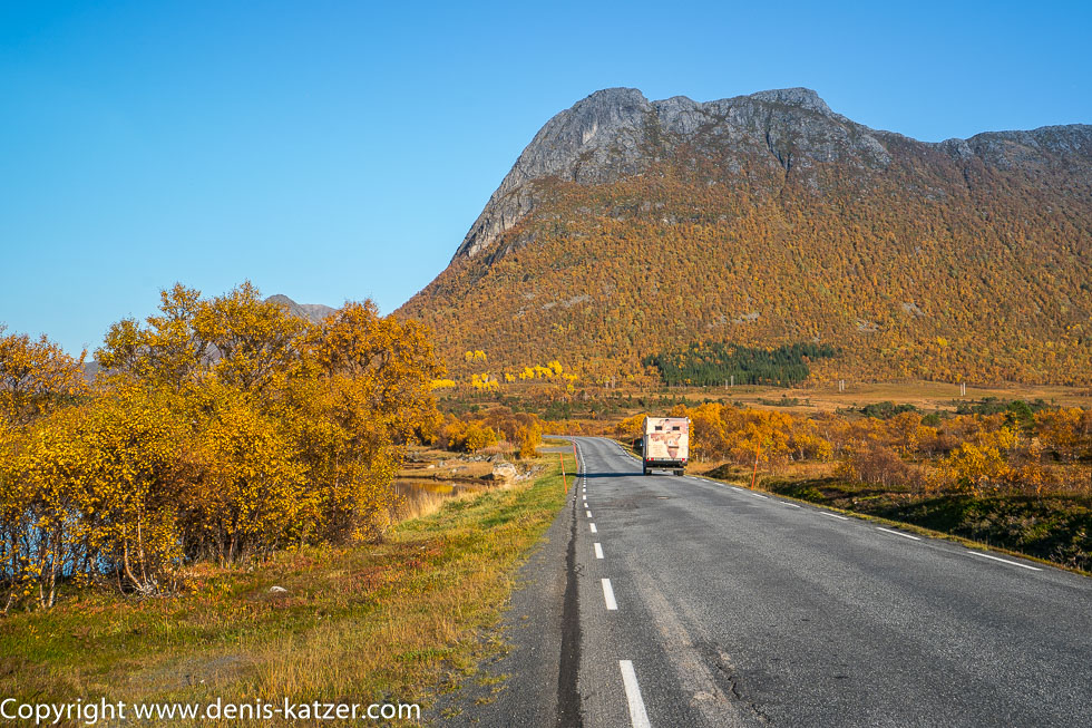
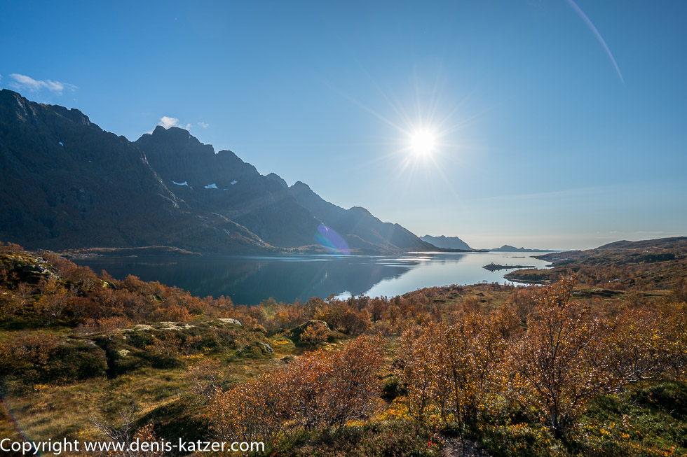
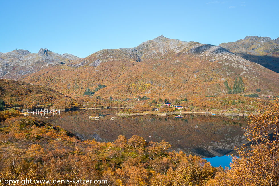
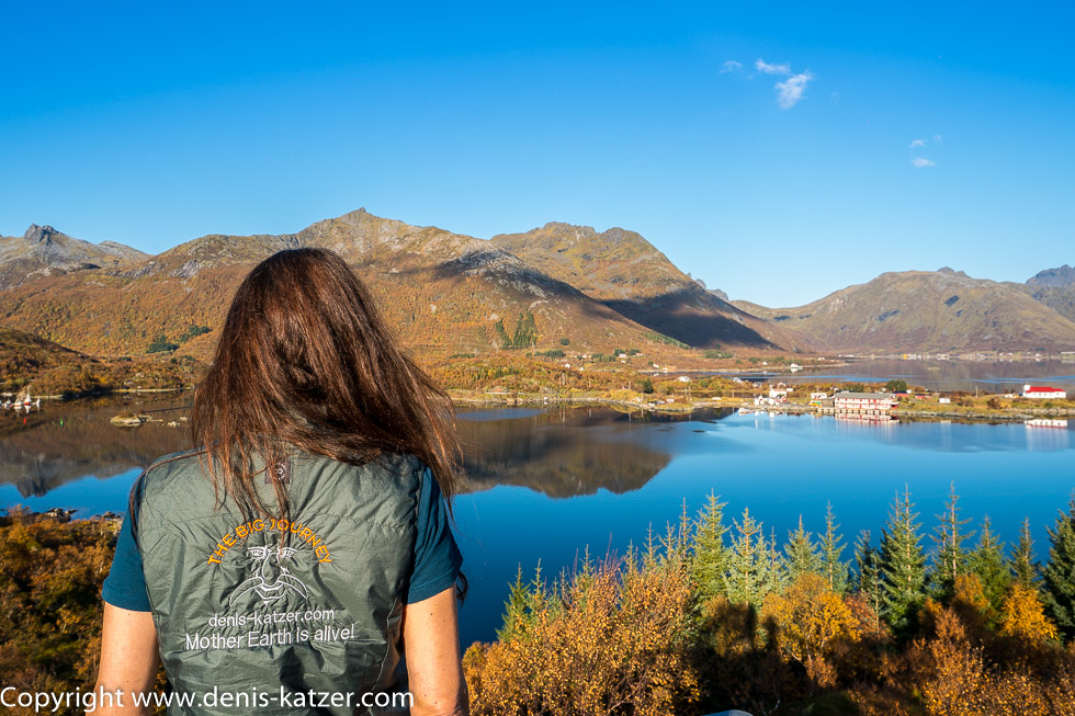
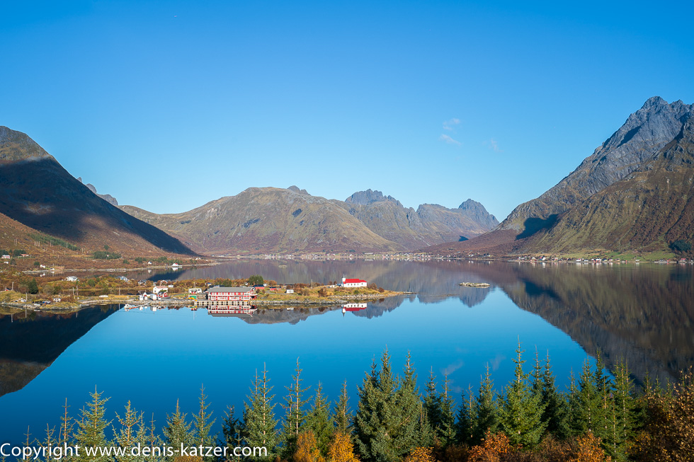
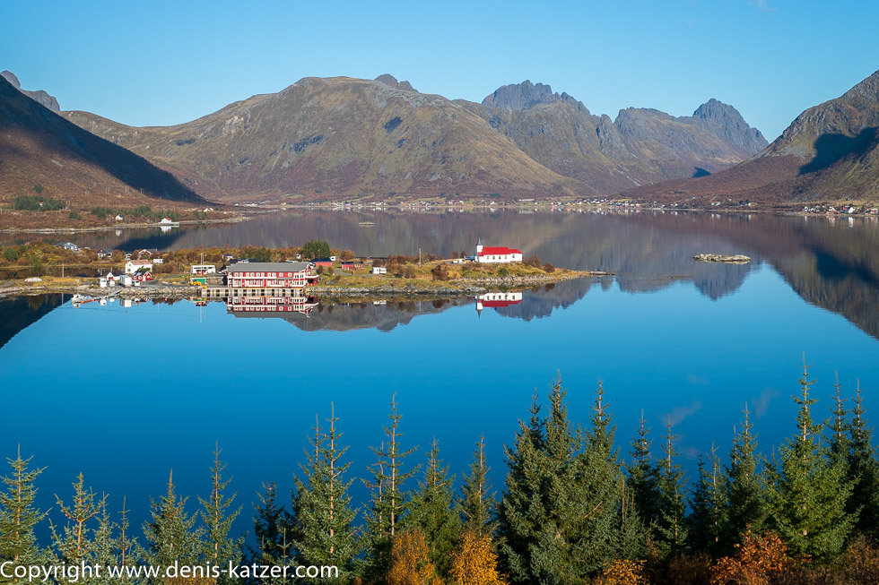
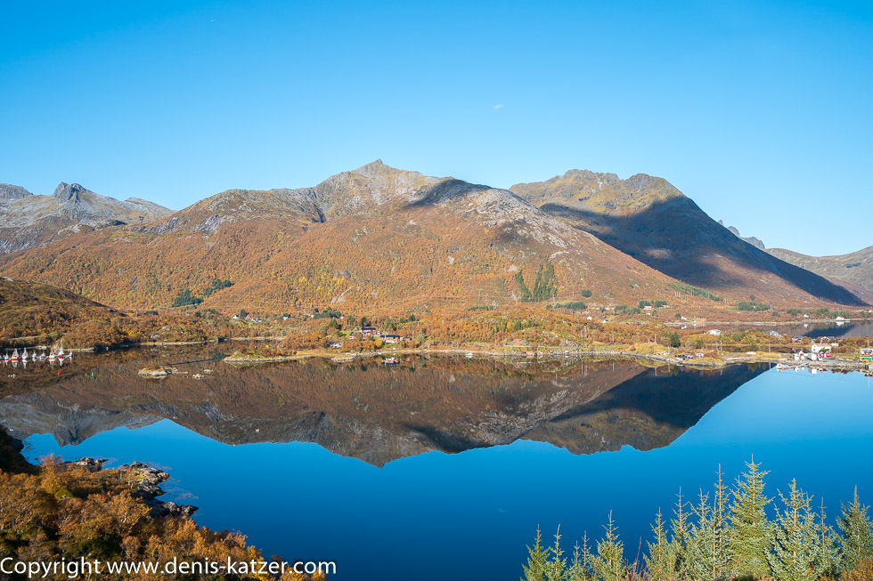
After our invigorating breakfast, we leave this wonderful place and continue our journey via Lofoten towards the mainland. We leave the small island of Gimsøy, which is literally wedged between the main islands of Austvågøya and Vestvågøy and has a relatively flat appearance compared to its island neighbors. A large part of the landscape consists of peat bogs that were mined in the past. As there were hardly any trees on Lofoten, peat was the only fuel available to the population. Today, the entire island is a nature reserve and because peat is no longer allowed to be extracted, many residents have moved to the neighboring islands. Then the E10 takes us to Austvågøya, the second largest island in the Lofoten chain, until we reach Hinnøya, which is the largest Norwegian island with the exception of the Svalbard archipelago. The Lofoten archipelago is now behind us and the Vesterålen archipelago, which consists of six islands and is located around 300 north of the Arctic Circle, lies ahead. “From atoll to atoll,” says Tanja with amusement, although we hardly notice that the respective land masses are separated from each other by fjords, bays and inlets thanks to the bridges and tunnels. “In the past, when there were no bridges or tunnels, the inhabitants were forced to travel in small rowing or sailing boats. The routes were therefore often long, and traveling was exhausting, laborious and sometimes dangerous,” I say, steering the Terra over a bridge again. “I can well imagine that traveling was so difficult for the islanders back then that many never left their little world,” says Tanja. “It certainly was. Apart from that, traveling is still an absolute luxury today.” “What do you mean?” “I think that of the 7.7 billion people currently living on our planet, only a relatively small proportion can actually travel. Due to the growing prosperity on our planet, more and more people can afford to travel, but many Indians, Africans etc. will not see much more than the village in which they were born. The World Bank’s official figures are frightening, because almost half of the world’s population lives on less than 5.50 dollars a day.” “5.50 dollars a day?” Tanja repeats, shocked. “Yes, and around 10% of the world’s population has less than two dollars a day.” “Unbelievable, and here we are driving for months in a high-priced expedition vehicle through one of the most expensive countries in the world,” says Tanja. “That’s right. That means we belong to the privileged people on this earth.” “I know, I have been aware of that for a long time. I am infinitely grateful for it every day.” “Me too,” I say through our conversation, even more grateful than I was before, gazing at the fairytale landscape that never ceases to boast of its endless beauty.
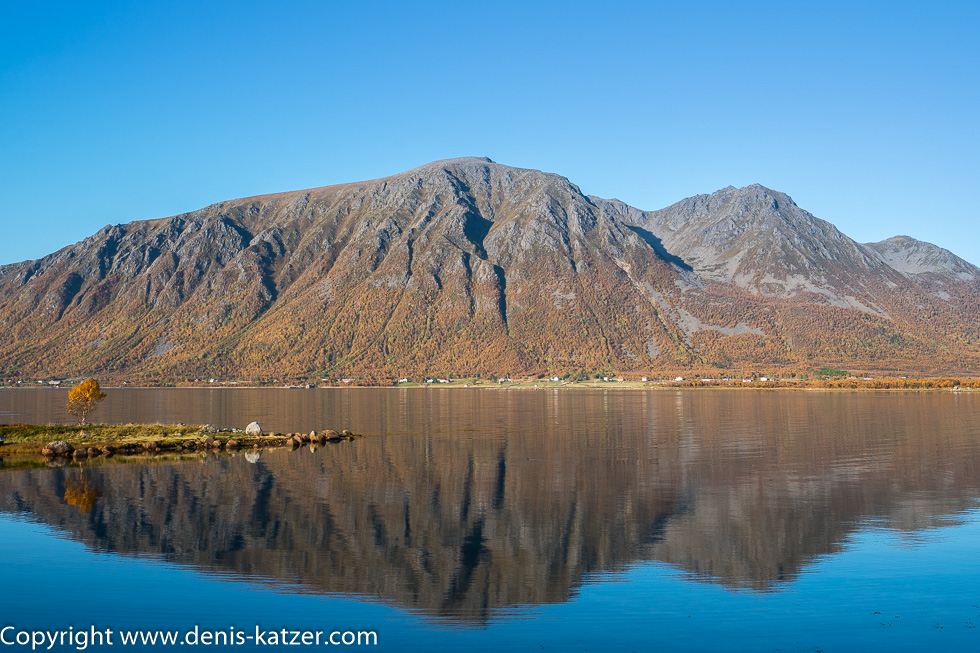
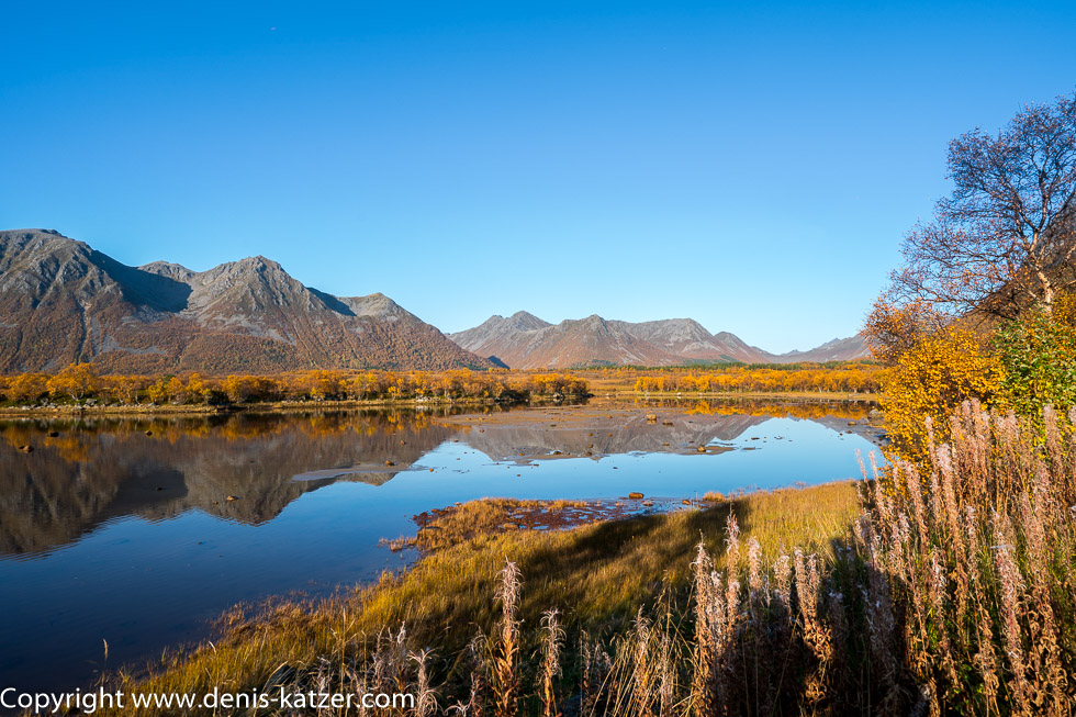
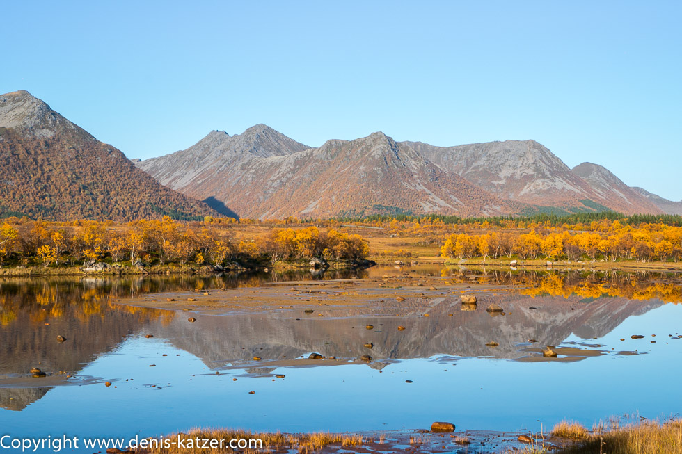
We leave the European route 10 and now follow the RV 85, with a steel-blue sky above us, contrasting with the golden autumn colors, the clear waters of the numerous fjords, the impressive mountains and valleys. Even though Vesterålen lies around 300 kilometers north of the Arctic Circle and at the same altitude as Greenland, the climate is very mild thanks to the Gulf Stream. “How cold does it get here in winter?” Tanja wants to know. “In the coldest month of February, the average temperature is minus 2 degrees. Here in Franconia, it’s plus 3° degrees,” I recite. “That means you can live quite well here in the far north. Quite different from what I had always imagined.” “Yes, so it’s no wonder that this archipelago is also known to have been settled here 6000 years ago by hunter-gatherers who lived primarily from fishing and hunting. Recent finds of 11,000-year-old charcoal even prove that people were already living here during the Scandinavian Stone Age. There are also old rock carvings on the coast here, which indicate a great deal of human activity in the Late Bronze Age. Perhaps we will still have the opportunity to visit them?” “If the drawings are on our way, why not? Otherwise, we should continue towards the North Cape after the whale safari. Who knows when winter will strike here, and I’d like to remind you that we don’t have any snow chains with us,” Tanja interjects.