From Tan-Tan to Daklah
N 23°54'05.0" W 015°47'14.1
Date: 12.12.2023 to 15.12.2023
Day: 374 – 377
Camp 70
Country: Morocco
Place: Daklah pitch
Latitude N: 23°54’05.0″
Longitude W: 015°47’14.1″
Daily kilometers 506 km
Total kilometers: 9605 km
Height 5 meters
Temperature day max 25°
Night temperature: 19°
Departure: 08:00 am
Arrival: 22:30
Travel time: 12:30 hours
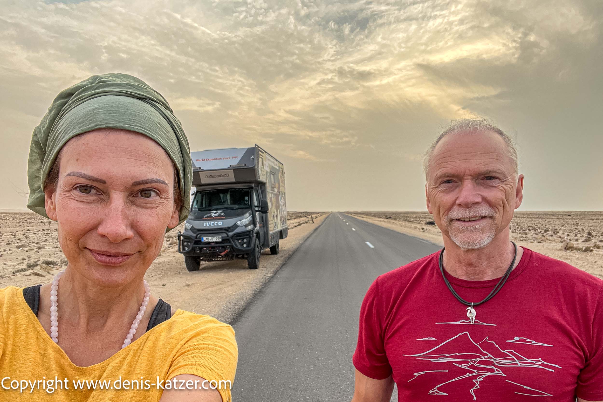
We leave the campsite in the coastal village of El Quatia, which lies on the Atlantic Ocean near Las Palmas de Gran Canaria, and continue our journey on National Road 1.
We still have 1,112 kilometers of desert ahead of us before we reach the border with Mauritania. We are unsure about the condition of the road. Will bad roads and slopes make the route more difficult? We don’t know, because we haven’t met anyone who could have given us reliable information. As we only have 6 days left until our visa expires, we are a little nervous. Now there must be no breakdown or anything else in between.
So far, however, the road has been freshly built and is perfect apart from a few construction sites.
Initially, we were unsure whether we should drive through Western Sahara to Mauritania, as this region has been the subject of a political conflict since 1975 in which thousands, perhaps even tens of thousands of people have lost their lives. The exact number of fatalities is not known and remains the subject of debate and research to this day.
Western Sahara, also known as the western part of Morocco by its Moroccan name, was once a Spanish colony until Spain withdrew in 1975.
Before I continue, however, I would like to mention that it is currently considered safe for travelers and tourists to drive through this impressive stretch of desert. At least that is our experience and personal opinion. Nevertheless, it is important to keep an eye on the political situation before traveling.
Brief explanation:
The Western Sahara conflict is a territorial dispute between Morocco and the Frente Polisario over the territory of Western Sahara. Frente Polisario translates as the Popular Front for the Liberation of Saguia el-Hamra and Río de Oro. It is a political-military organization in Western Sahara.
Morocco claims Western Sahara as an integral part of its territory, while the Polisario is striving for the territory’s complete independence. In 1976, the Polisario proclaimed the Sahrawi Arab Democratic Republic, which was recognized by around 80 states. However, around 30 states have withdrawn their recognition or suspended it until the conflict is resolved.
The vast territory of Western Sahara covers an area of around 266,000 square kilometers. For comparison: Germany has an area of around 375,000 square kilometers. Western Sahara is divided into a larger western area under the control of Morocco and an eastern and southern part, also known as the Free Zone, which is controlled by the Frente Polisario.
As tourists and travelers, we are often not aware of the political background, and in most cases that is a good thing, because we want to see and explore the country and not burden ourselves with political issues. Nevertheless, it can sometimes be useful to find out a little about the background, history and past.
As some of our Moroccan friends also watch our videos, we would like to ask you to forgive a possibly inappropriate statement. We love your beautiful country. For us, it is one of the most interesting and hospitable countries on our wonderful Mother Earth.
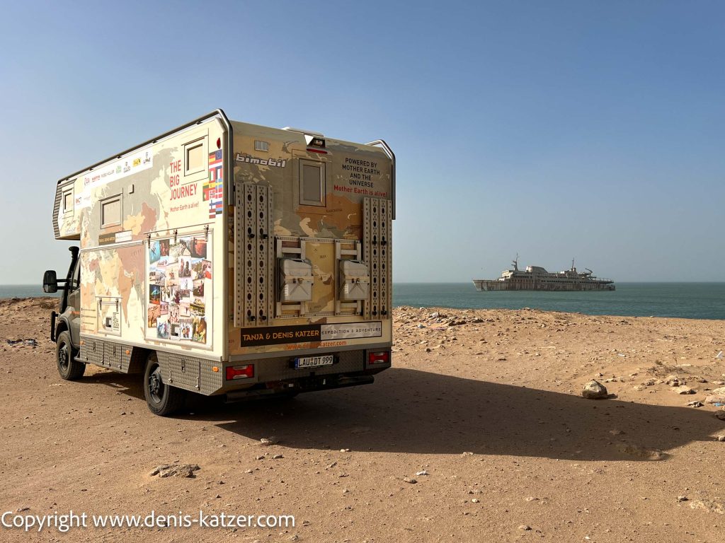
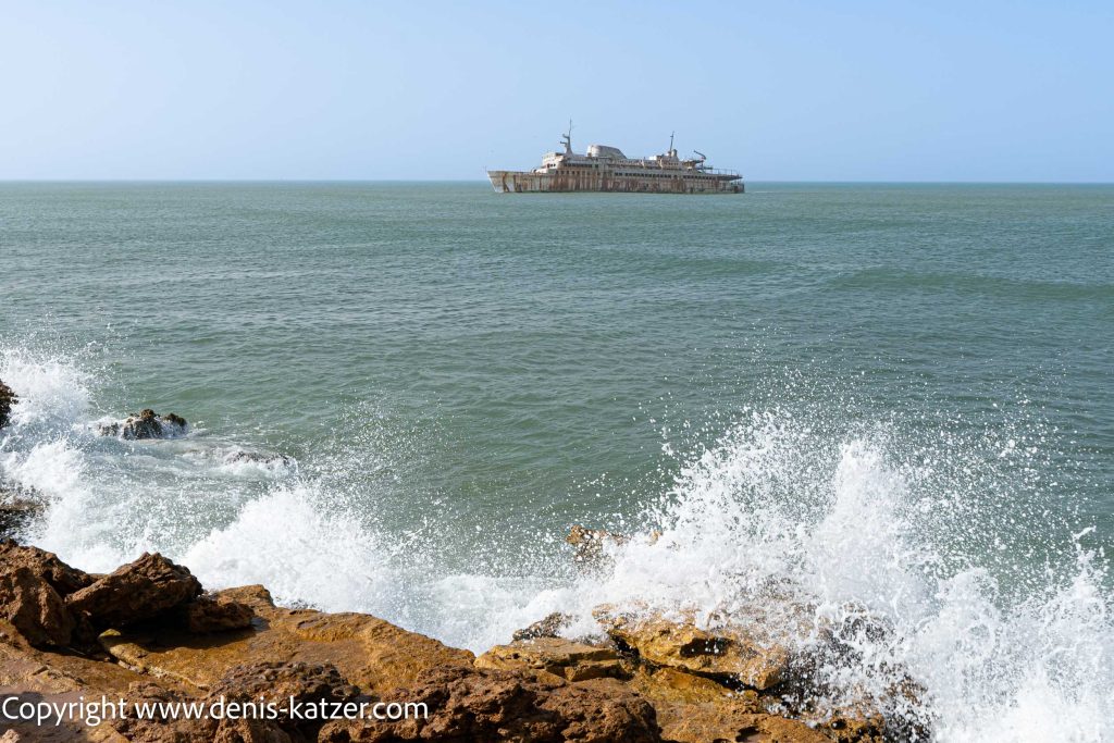
A shipwreck suddenly appears on the white sandy beaches of Morocco. It is the sardine fisherman “Que Sera Sera” from Iceland, which means “What will be, will be”.
From what we heard, the boat was suddenly on the beach and the crew had disappeared without a trace. Nobody knows why. Rumor has it that cocaine money was laundered here through sardine fishing. We will never know whether the ship was deliberately grounded by its owners.
Although some overlanders may find the 1260-kilometre desert route from the town of Guelmin to the Mauritanian border monotonous and boring, it is a highlight for us. It is a route where the restless thoughts of a stressed European have the opportunity to come to rest.
SANDSTORM
Suddenly, a sandstorm sweeps across the desert. The wind is so strong that I have to hold the steering wheel tightly to prevent our Terra Love from being pushed off the road.
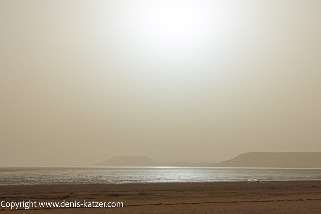
The sandstorms of the Sahara, also known as “Harmattan”, are an impressive meteorological phenomenon that occurs regularly in the region of North Africa. These storms are caused by dry, dusty winds blowing westwards from the Sahara desert region. These winds transport huge quantities of fine sand and dust, which is often carried over long distances.
They can reach immense proportions and even cross the Atlantic. The dust carried along can severely impair visibility and lead to extreme weather conditions.
The sandstorms in the Sahara not only have a local impact, but also influence the climate worldwide. The dust transported by the storms can enter the atmosphere and reflect cloud formation and sunlight, which can have an impact on the climate in various regions.
The tiny particles in the dust carried can cause health problems, especially respiratory diseases. People and animals in the affected areas must protect themselves from inhaling the fine dust.
After 287 kilometers we reach the town of El Aaiún, which translates as “The Source”. The earliest reports from Arab sailors date back to the 14th century. They came from the Maghreb and mostly reached the coast shipwrecked.
The city is located around 25 kilometers from the Atlantic coast in an arid desert landscape. It stretches along the Saguia el Hamra, a dry river that rises in the stone desert in the east and is stopped by sand barriers north of the city. The Saguia el Hamra valley is home to the only large freshwater lake in the country, which forms at the end of the rainy season in the fall. To the west and north of the city are sand dunes, which are often blown up by strong summer winds.
For the onward journey through the desert and also due to the higher cost of drinking water in Mauritania, we decide to replenish our water supplies here.
Meanwhile, Tanja is resting in the alcove with severe headaches and aching limbs. She suddenly fell ill.
24 kilometers from El Aaiun, we find a pitch for the night at the Plage de Laayoune.
We set off early. The sky is cloudy and another sandstorm is brewing. The sun is obscured by clouds of dust and looks like a bland, faintly shimmering ball. However, the road conditions are excellent. The road is perfectly maintained and new.
When we see stray dogs, we sometimes stop to feed them. In this way, the food that was intended for our dog Ajaci, who died in Morocco, will continue to be used and satisfy the hunger of one or two dogs.
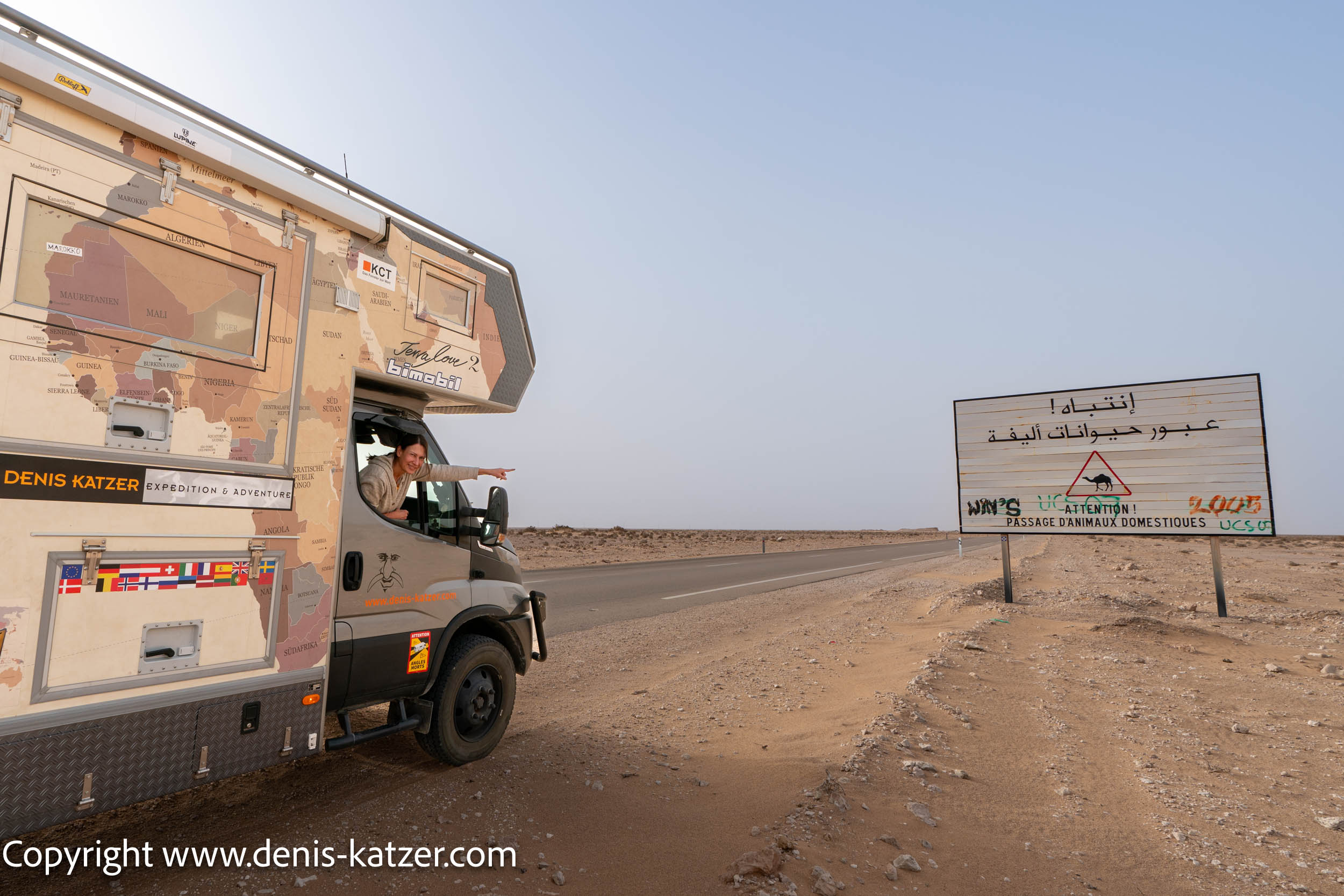
There are countless police checks in Morocco. So far we have never been stopped and have always been waved through in a friendly manner. Here in the western part of the Sahara we are stopped for the first time and have to show our passports.
Our goal is to make the 550 km to Dakhla today. We are making good progress. After 4 ½ hours, Tanja takes the wheel and drives another 200 km. Fortunately, she recovered very quickly. We suspect that the rapid headaches and aching limbs were the after-effects of her recent yellow fever vaccination.
Again and again we pass through small Moroccan settlements. Since its annexation of Western Sahara in 1975, Morocco has pursued a policy of colonizing the region. The settlements were built to strengthen the Moroccan presence in the region and to consolidate its claim to the territory. We hear that there are sometimes tensions and conflicts with the Sahrawi in these places.
The Sahrawi are a Berber people who have lived in this region for centuries. They led a nomadic way of life, which was characterized by livestock farming and traditional forms of economy.
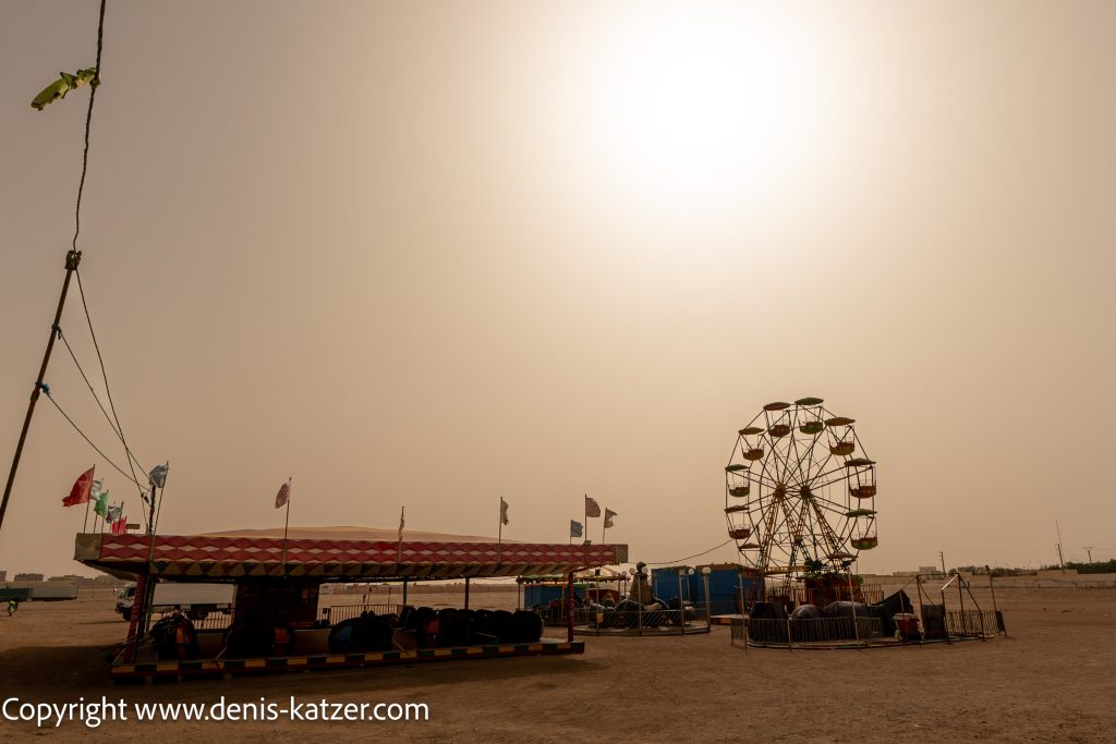
The impressively large ball of sunlight, veiled by Saharan dust, tilts towards the horizon just before setting as we leave the main N1 road and drive towards the town of Dakhla. Dakhla lies at the end of a narrow spit of land that stretches between the Atlantic Ocean and the Dakhla lagoon.
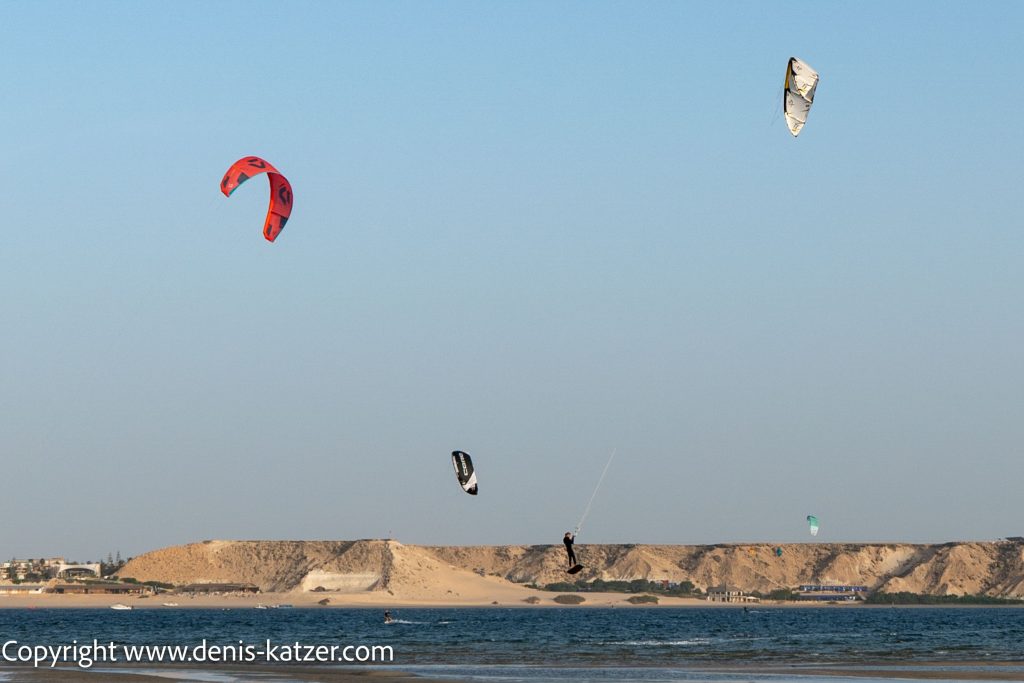
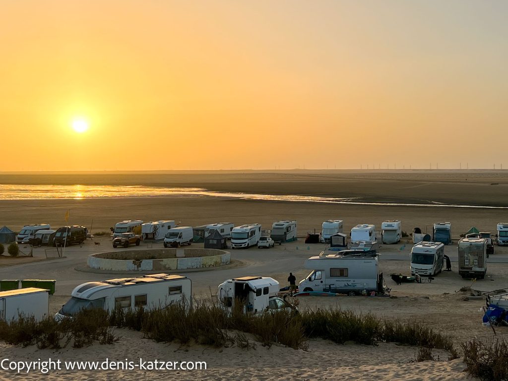
About 25 km before Dakhla, shortly after the road bends in a south-westerly direction, we discover a beautiful and free place to spend the night between kitesurfers and windsurfers before nightfall.
As we have made good progress, we will spend 3 nights here before tackling the remaining 350 km to Mauritania.