Crossing the Huashan Mountains
N 34°05'07.6'' E 110°08'15.7''
Date:
17.01.2016 until 21.01.2016
Day: 203 – 207
Country:
China
Province:
Shaanxi
Location:
Luonan
Latitude N:
34°05’07.6”
Longitude E:
110°08’15.7”
Daily kilometers:
94 km
Total kilometers:
11,790 km
As the crow flies:
50 km
Average speed:
19.3 km/h
Maximum speed:
44.1 km/h
Travel time:
4:52 hrs.
Soil condition:
Asphalt
Maximum height:
1.700 m
Total altitude meters:
15.450 m
Altitude meters for the day:
1.521 m
Sunrise:
07:44 am
Sunset:
5:53 pm – 5:55 pm
Temperature day max:
minus 2°C
Temperature day min:
minus 15°C
Departure:
10:00 a.m.
Arrival time:
4:15 pm
(Photos of the diary entry can be found at the end of the text).
I sit over the map for a long time, trying to find a way around the smog-ridden city of Xi’an. “I definitely don’t want to go back there,” says Tanja. “As it stands, there is only one alternative and that is from here via the Huashan Mountains to the south. If we decide to take this route, we will have to accept a total detour of 400 km and, above all, there are 900 km of mountains ahead of us on this stage to the next big city, Chengdu. The next 100 km could be tough. Look at the structure on the map. It’s very dark. So we head uphill. No idea how many vertical meters the pass roads will wind over the mountains in this area. We won’t know until we get there. The easier route would be to drive back to the imperial city from here. With this route, we would only have about 480 km of mountainous country ahead of us to Chengdu and, above all, this route is 400 km shorter.” “Never mind, let’s take the pass road over the mountains. The air is certainly much better there and who knows, the landscape is more beautiful. We can manage that with our batteries, can’t we?” asks Tanja. “I don’t think that’s a problem. With six batteries each, we should be able to overcome high altitudes without breaking down. The journey we have already made over the Qin Ling Mountains has proven this. However, it depends on how extreme and long the inclines are. That takes a lot of power. We also have to bear in mind that there could be snow up there. Without spikes on the tires, a mountain crossing would not be possible. Nevertheless, I have to agree with you. The tour over the Huashan Mountains, which are still part of the Qin Ling Mountains, promises to be adventurous and a detour of a few hundred kilometers is not important on our journey. We have time and if there is snow up there we will find a solution. If necessary, we’ll turn back. The main thing is that we enjoy this trip through China,” I say and start planning the details of the next few days. After finding a place called Luonan, about 100 km from here, I send the coordinates to Lois, who has now taken over Magaret’s job at Bosch in Shanghai. She was the one who offered to help us find accommodation months ago. Now that Margaret has left the company, Lois is back to finding a place for foreigners, dogs and bikes to spend the night at the end of a strenuous day’s ride. We eagerly await their answer as to whether there is any accommodation at all in Luonan and if so, whether they accept a dog and bikes. It now depends on whether we dare to take this mountain route. Just an hour later, we receive the good news. “I found a place for you three. Have a good trip.” (I’ve found a place for you three. Have a good trip) “Great, the trip over the Huashan Mountains and the Qin Ling Mountains is booked,” I say triumphantly.
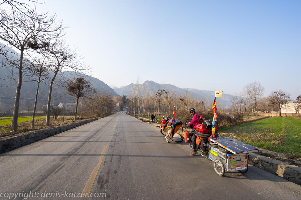
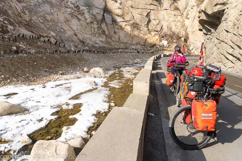
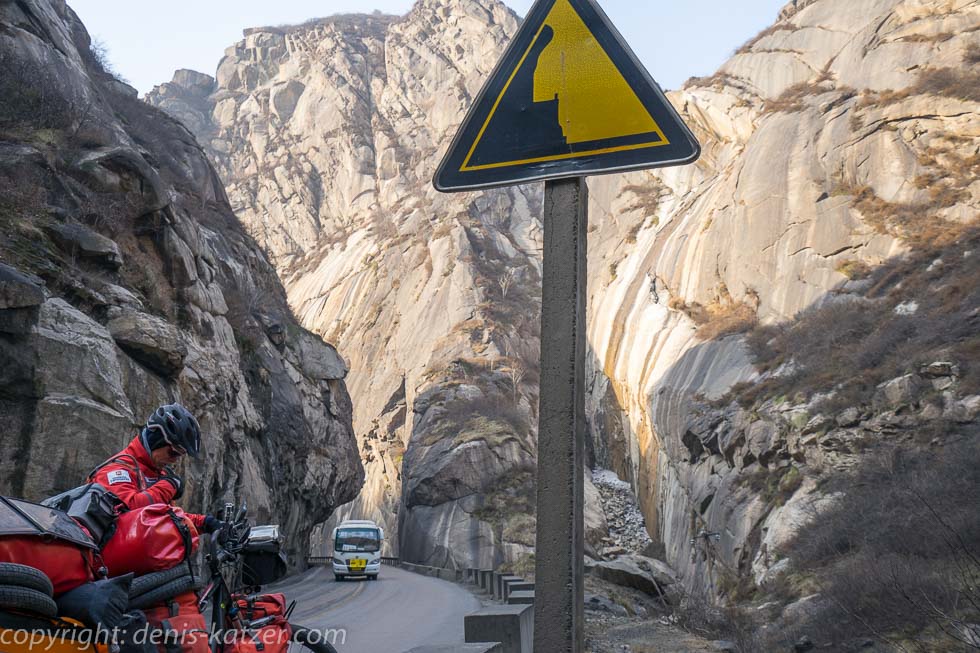
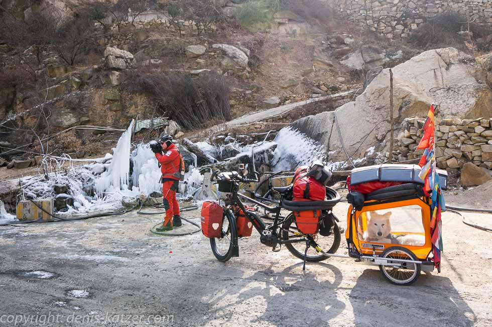
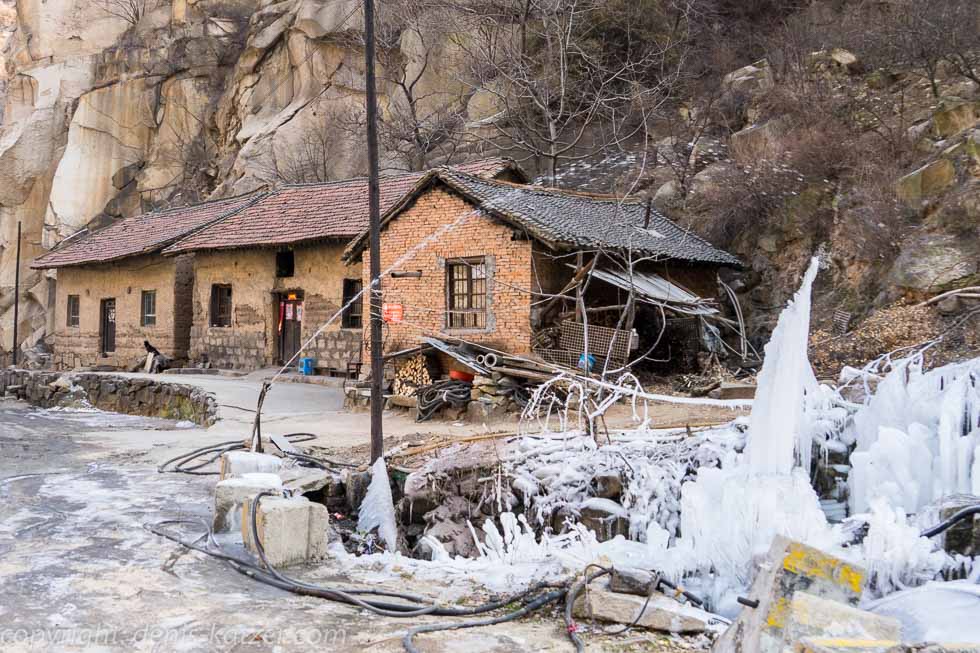
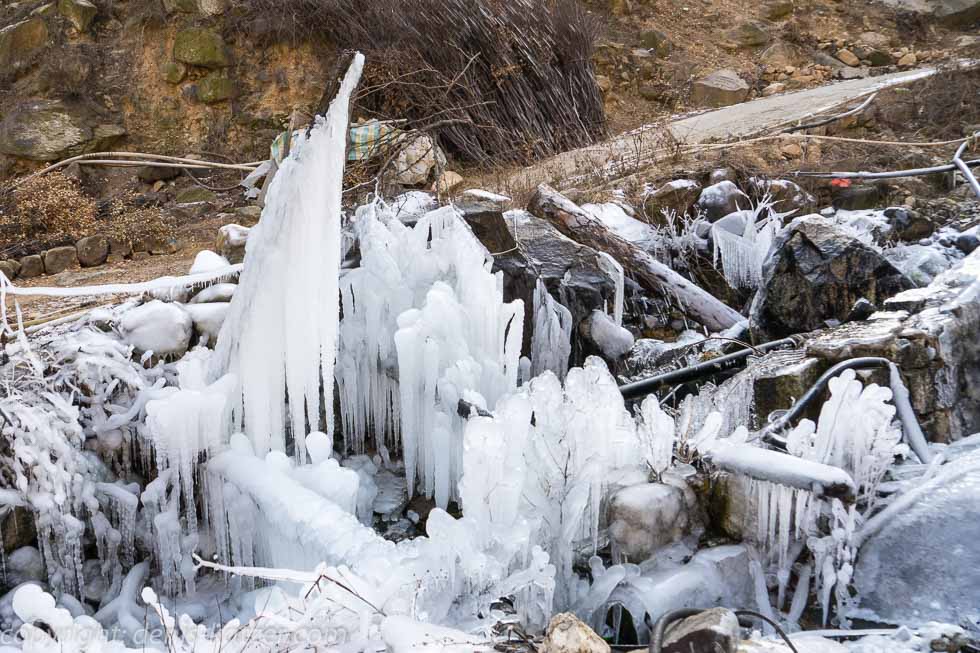
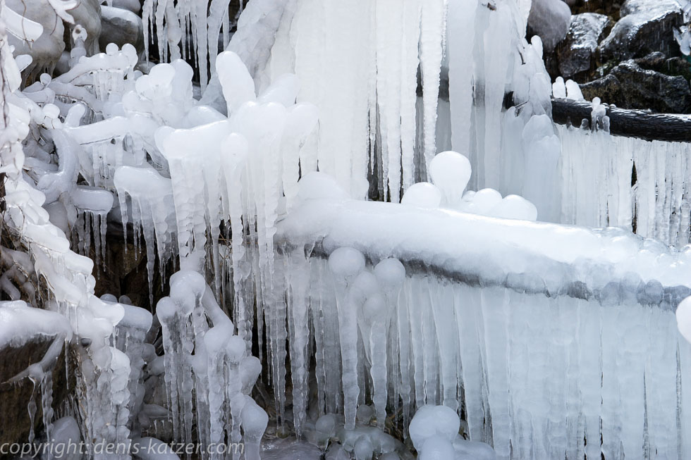
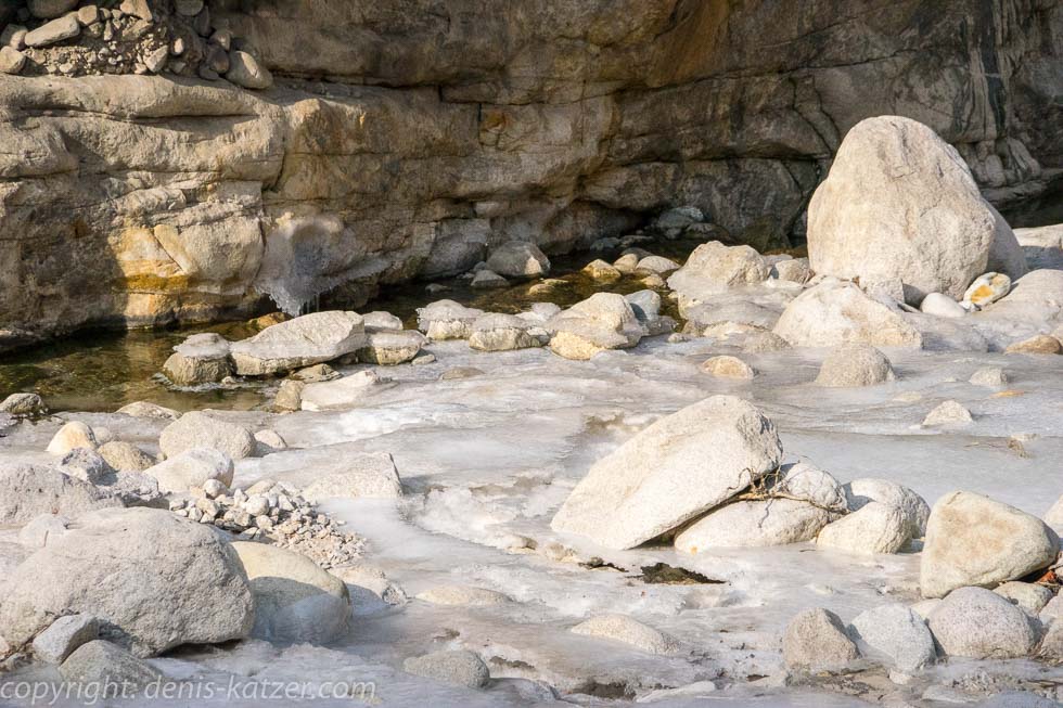
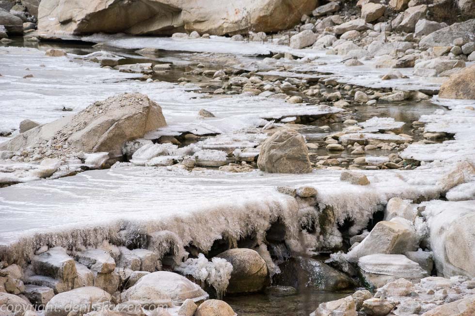
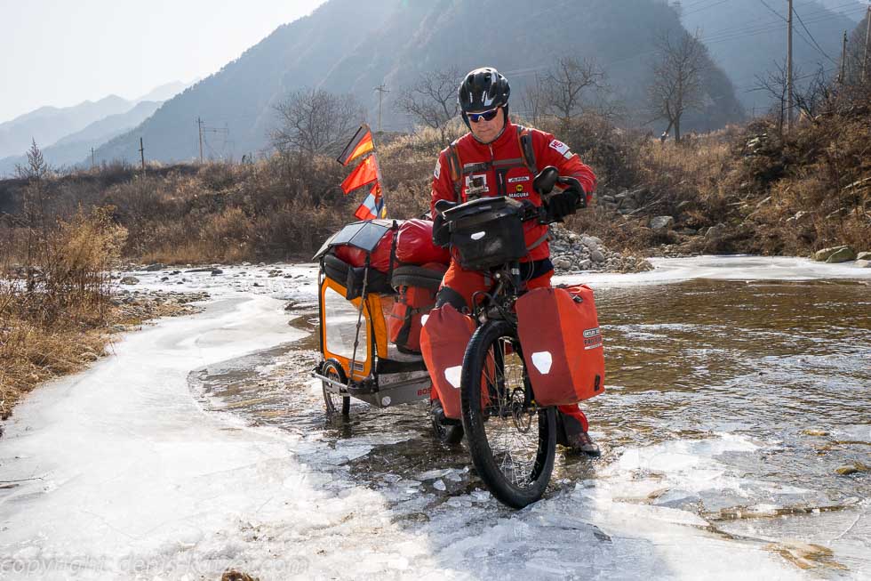
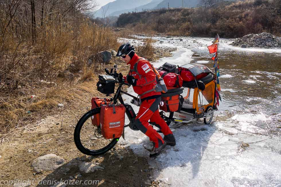
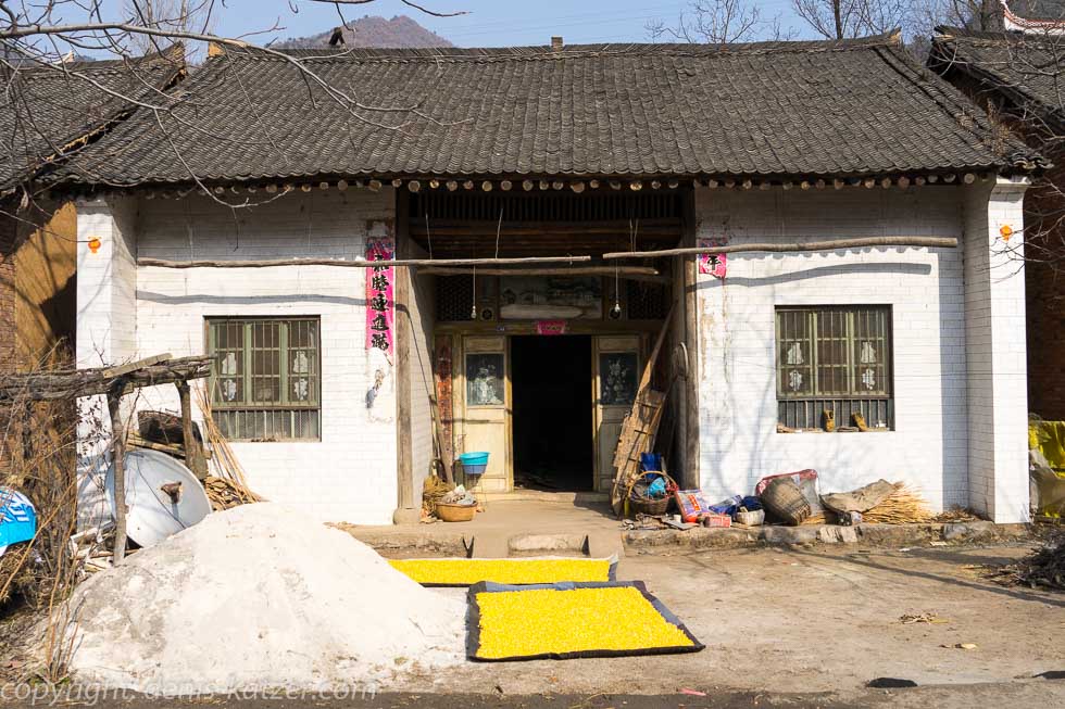
The next day we set off in glorious sunshine. After ten kilometers, we leave the main road and follow a smaller one to the south. The imposing, majestic mountains rise up in front of us. “We have to get over it!” I shout, not sure at the moment whether we’ve taken on too much. As soon as our road meets the mountain range, we head upwards. At first leisurely but soon quite steep. We have the luxury of pedaling uphill in turbo mode. 8 km/h is the maximum speed. Our Bosch engines have to deliver top performance. “What range does your on-board computer show?” I call out to Tanja. “Eight!” “Eight?” “Yes.” “Mine too,” I reply and hope that we get to the top soon, otherwise we’ll never make 100 km. During a short break, I suggest blowing through the first three batteries in full power mode. “Only from the fourth should we think about switching down to sport mode to save energy,” I think as we start battery two. We cycle through a dark, cold gorge, bordered on the left and right by massive, steep rock faces. The river we are following is frozen in most places. In the meantime, we have worked our way up from 400 to 700 meters in altitude. “How far up do you think it will go?” asks Tanja. “Maybe at 1200 m?” I guess. “Just watch out. The roads are slippery in places,” warns Tanja. “I know,” I reply, because the trucks driving down into the valley cool their brakes with water here too. “They’re crazy for spraying water on their brakes in this cold,” I say, because then the braking power is maintained, but it’s no use if they slide along on bare ice and, in the worst case, fall into a ravine. We stop again and again to photograph bizarre ice formations. Every few kilometers, a simple hut huddles on the side of the road. Water sprays out of a hose. It runs onto the road and turns it into a dangerous ice surface. The water is drawn from the nearby mountain river and sold to the truck drivers. They in turn fill it into their tanks to cool the brakes. I suspect that the poor inhabitants of this valley earn a little money this way. We stop to take photos of the bizarre ice formations that are created when the water spraying out of the hose in a high arc hits the cold rock and freezes immediately. Only now do we realize that we are standing on bare ice with our bikes. “You have to be very careful here. Don’t use the front brake under any circumstances,” I warn Tanja as we struggle to push our Delites onto the road.
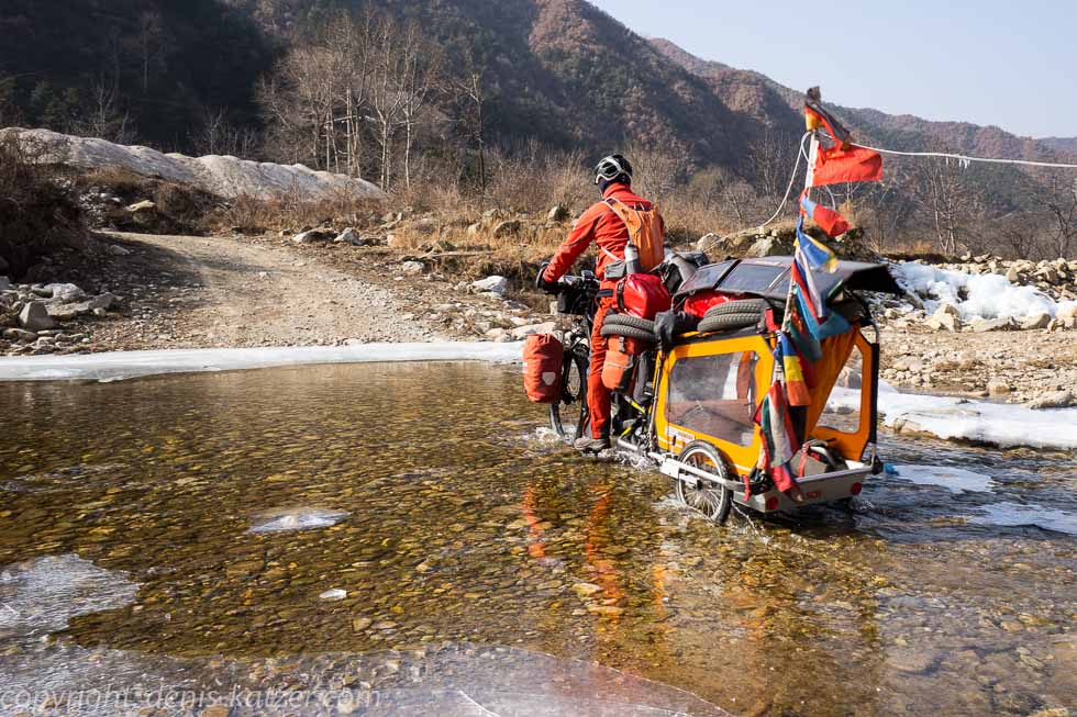
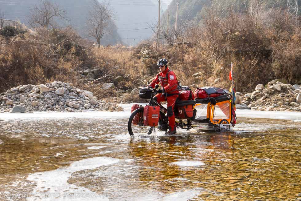
We are now at an altitude of 1000 m and are using the third battery. We had covered just 25 km to get here. The thermometer reads 12 degrees below zero. It is still going steadily upwards. The mountains around us are breathtakingly beautiful and the air is pure and clear. “A wonderful day on the bike!” I rejoice. “Yes, you’ve picked out a great route for us,” praises Tanja. Although it is exhausting, we are happy. We feel free, our lungs breathe clean air, our heart beats strongly and our muscles pump blood through our body. Suddenly the road is temporarily closed due to a landslide. Traffic comes to a standstill for a while. We decide to cross the half-frozen river below us in order to avoid the stop. It’s a bit risky as the ice at the edge of the river is quite slippery. However, we get through and over this barrier ourselves with our road systems and continue our journey unhindered.
We wind our way further and further upwards. Of course, compared to the Himalayas, this is just a foothill, and yet this pass is one of the longest climbs since we set off on our journey in Germany many years ago.
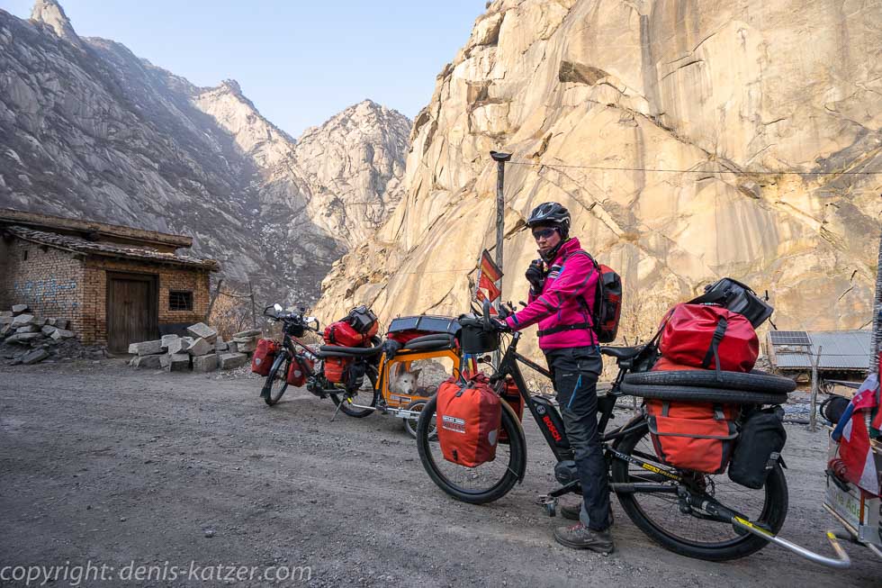
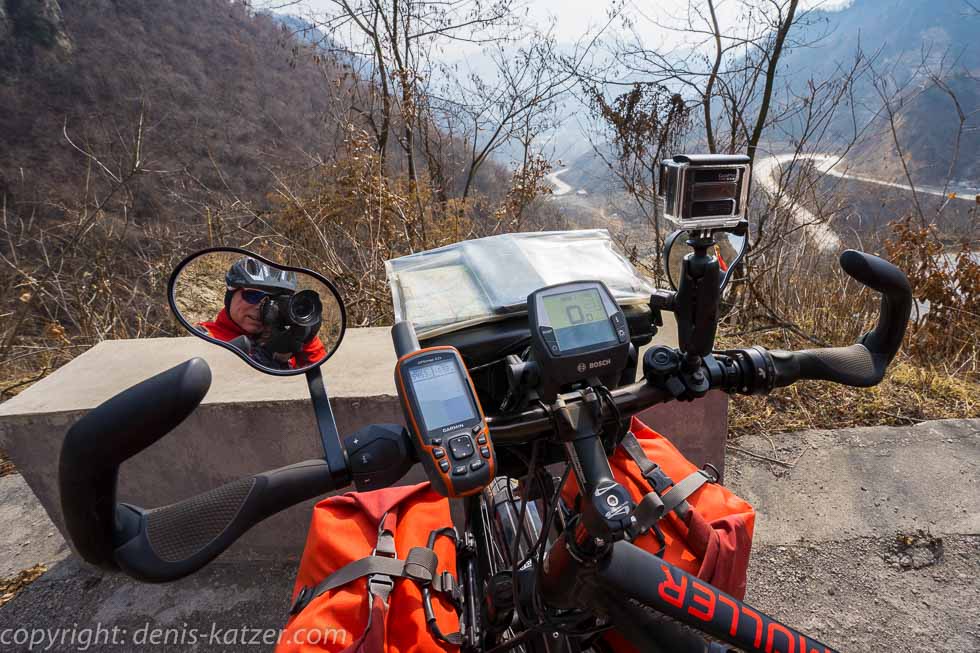
On the 15,000 km from Germany to Mongolia, we crossed the Swabian Alb, the Carpathian Mountains in Romania, the Ural Mountains in Russia, the South Siberian Mountains, the Sayan Mountains in Siberia, parts of the Baikal Mountains, the Barguzin Mountains and the Chamar-Daban Mountains on Lake Baikal and, not to forget, the endless mountains in Mongolia with normal bicycles and trailers. We were forced to push our bikes up countless inclines. Absolute hard work. But here, in this area of the Qing Ling Mountains, our journey would definitely come to a halt without the support of the electric motor. This means that we have the chance to push the limits of what is possible, because if the engine fails, it would be impossible to push our road trains up this long pass. Again, we are grateful for the technology that has not let us down so far. At around minus 15 degrees, we pedal our bikes up to an altitude of 1,700 meters. Only now, after 40 km and the consumption of 3 1/2 power collectors, we seem to have reached the highest point. We still have just under 60 km to go. As the road is now going downhill, we decide to continue driving in turbo mode. A good decision, because the descent to 900 m is long and without any significant further altitude. We only need one battery charge for the entire route…
The live coverage is supported by the companies Gesat GmbH: www.gesat.com and roda computer GmbH http://roda-computer.com/ The satellite telephone Explorer 300 from Gesat and the rugged notebook Pegasus RP9 from Roda are the pillars of the transmission.