Atlantic Road – Building of the Century
N 63°01'05.8" E 7°21'52.5"
Date:
04.12.2020
Day: 124
Country:
Norway
Location:
Atlantic Road
Daily kilometers:
52 km
Total kilometers:
9189
Soil condition:
Asphalt
Bridge crossings:
10
Tunnel passages:
1
Sunrise:
09:38 am
Sunset:
3:01 pm
Temperature day max:
5°
Night temperature min:
3°
Wind
20 km/h
Time of departure:
12:00 p.m.
Arrival time:
1:00 p.m.
(Photos of the diary entry can be found at the end of the text).
Click here for the podcasts!
Link to the current itinerary
(For more posts click on one of the flags in the map
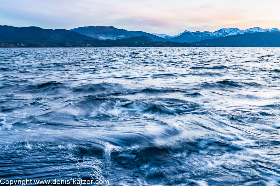
In the morning, the bay lies peacefully before us. We walk to the sea just after sunrise. In daylight, there is no longer any trace of yesterday’s mystical atmosphere. A few rough wooden tables, benches and fireplaces bear witness to the fact that this beautifully situated place is frequented by tourists during the warmer months of the year. The clear water laps peacefully onto the shore. “Woouuiii!” howls Ajaci and would love to jump into the cold water. “No!” I hold him back, because it would take ages for his coat to dry again in these temperatures. We sit down on one of the wooden benches and see an impressive bridge on the other side of the fjord. “Do we have to drive over there?” asks Tanja, pointing to the 1,257-metre-long Gjemnessund Bridge, which connects the mainland with the island of Bergsøya. “Yes,” I reply, keeping an eye on our dog, who obviously doesn’t want to accept my no. “It’s an impressive bridge,” says Tanja. “One of the longest suspension bridges in Norway and one of the top 100 in the world,” I reply.
Around midday, we leave the old Bronze Age settlement behind us and cross the suspension bridge 43 meters above the fjord. “Wow, look at all the birds!” exclaims Tanja enthusiastically. “Great to look at but a real problem for the authorities,” I reply. “Why is that?” wonders Tanja. “Because their droppings and urine contain ammonia, and this aggressive mixture and the salty water damage the concrete and asphalt. An issue for many of Norway’s bridges. The authorities can only counteract the rapid deterioration of the bridges by cleaning them regularly and covering the concrete with an elastic membrane to protect it from the harmful contents,” I explain. “Phew, that sounds like high maintenance costs.” “Absolutely. I think Norway can only afford its 22,700 bridges because the country’s estimated oil reserves are around 5.5 trillion euros. On top of that, there are around 252 billion euros in natural gas reserves. As far as I know, Norway is the fifth richest country in the world. In comparison, Germany is in 18th place.” “Incredible, then the cost of maintaining the bridges is just a drop in the ocean.” “You could say that,” I say, as another of Norway’s 900 tunnels sucks us in a few kilometers further on. The deepest point of the single-tube Freifjord Tunnel, which is over 5 kilometers long, is 130 meters below sea level, which is why it takes a surprisingly long time to get down there. After spending almost half a year in this country, exploring it from the far south to the far north and back again, a tunnel like this is no longer excitingly new to us. Nevertheless, we remain curious and enjoy every kilometer we drive, every natural beauty and the historical traditions of the early settlers.
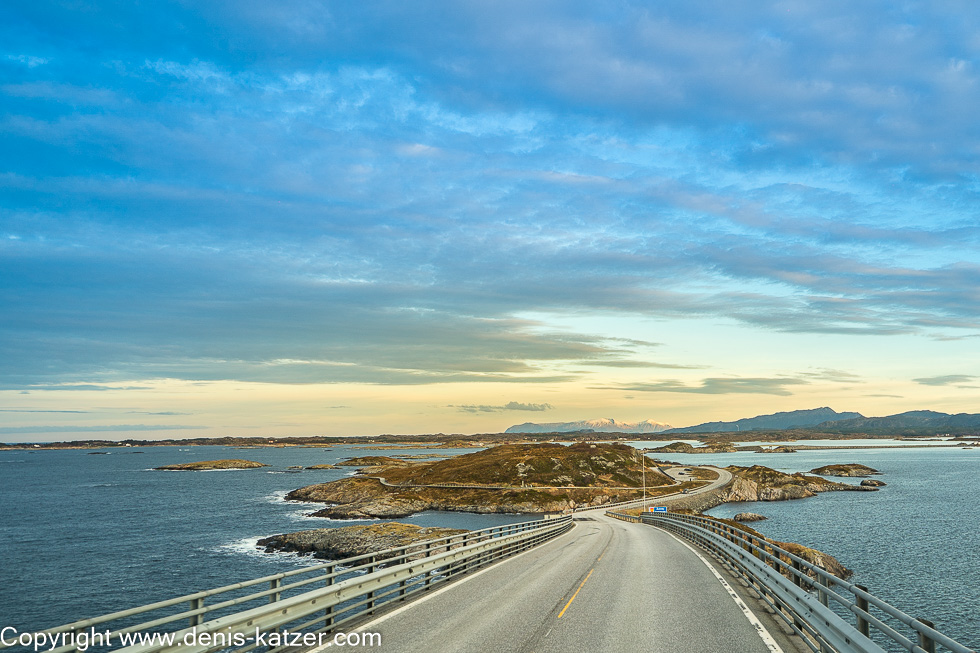
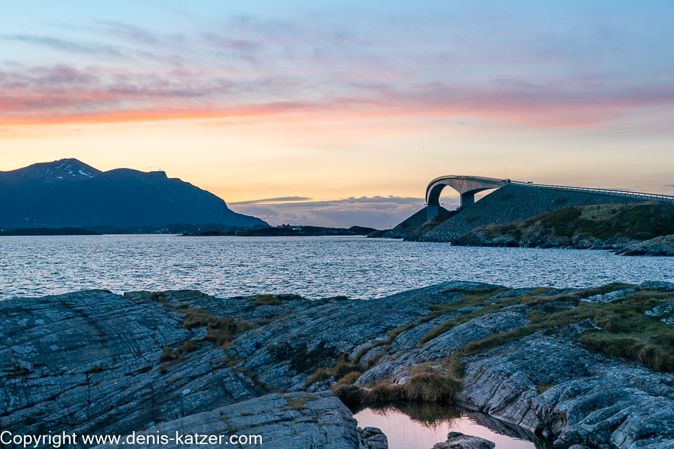
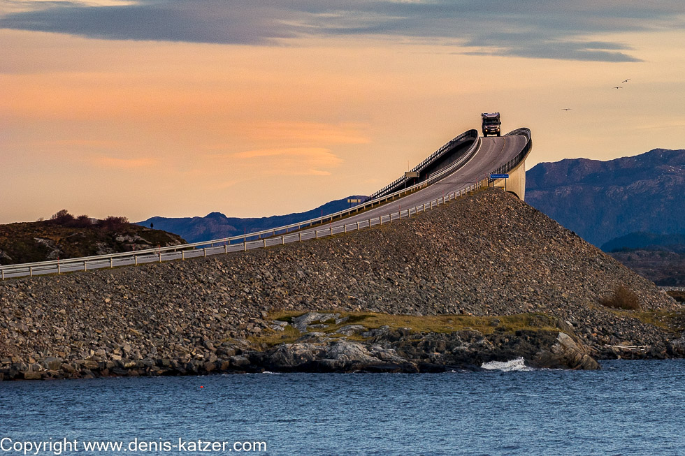
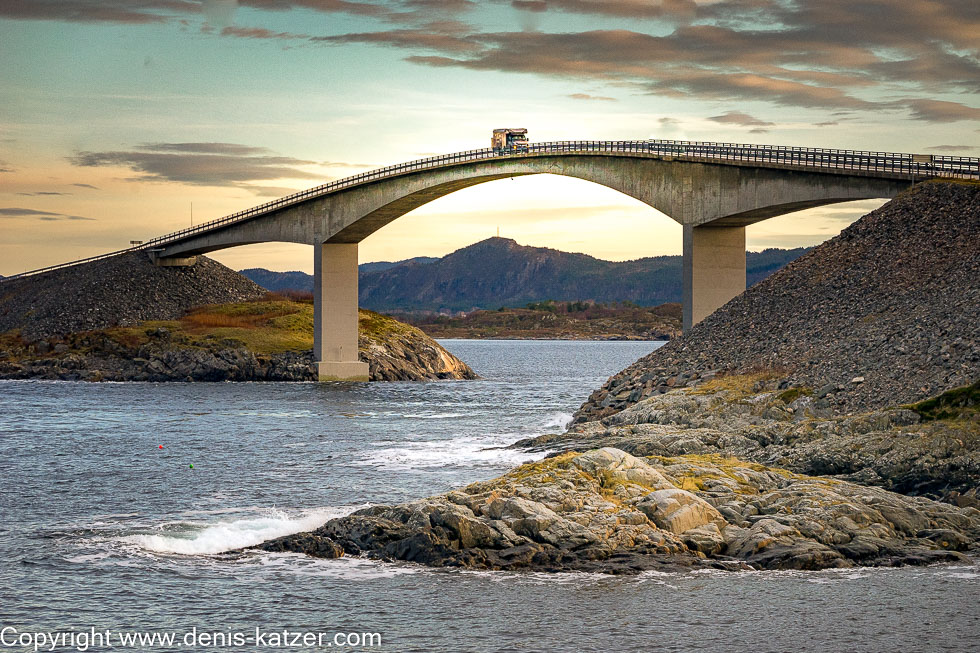
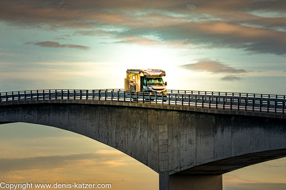
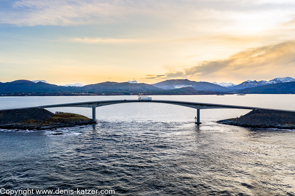
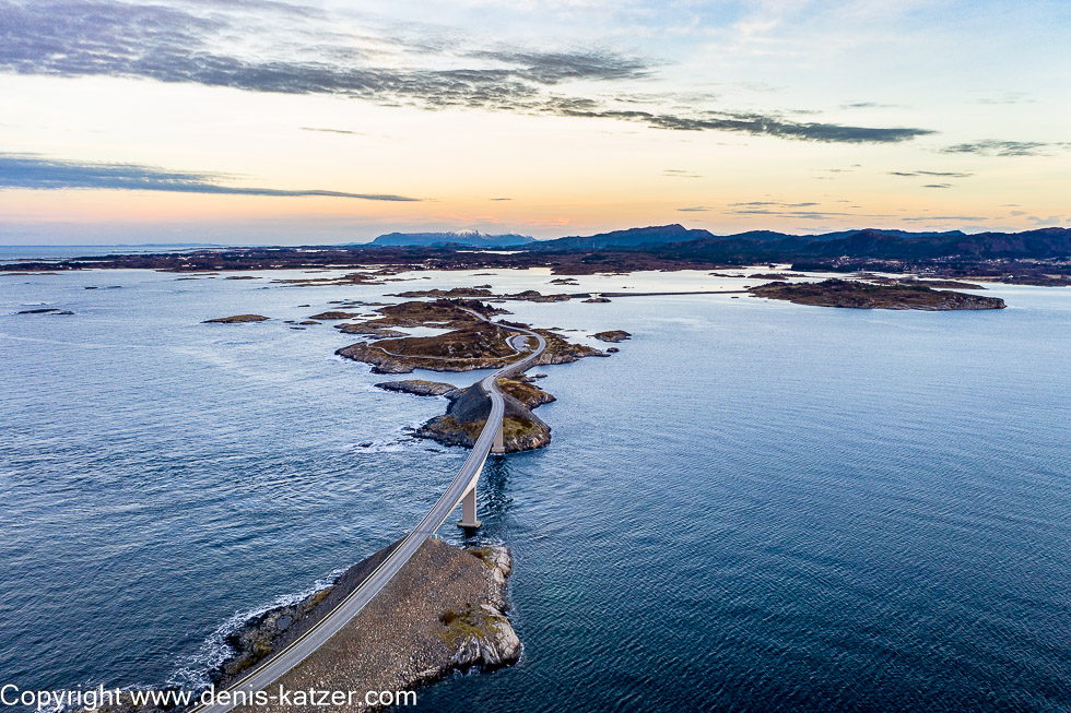
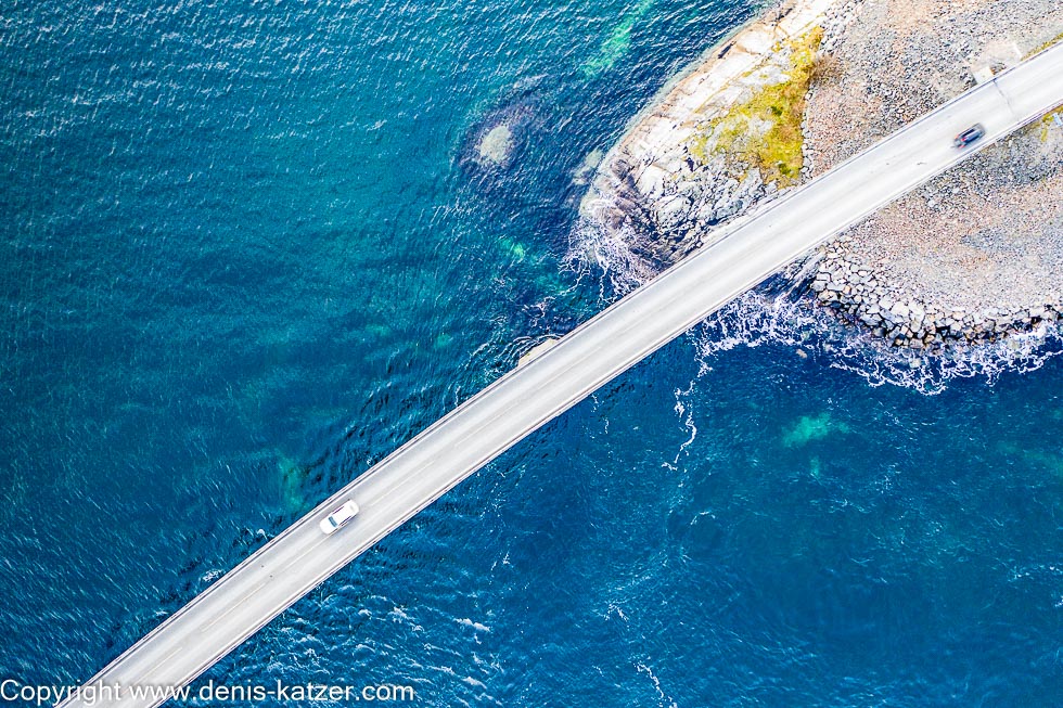
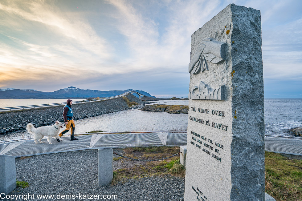
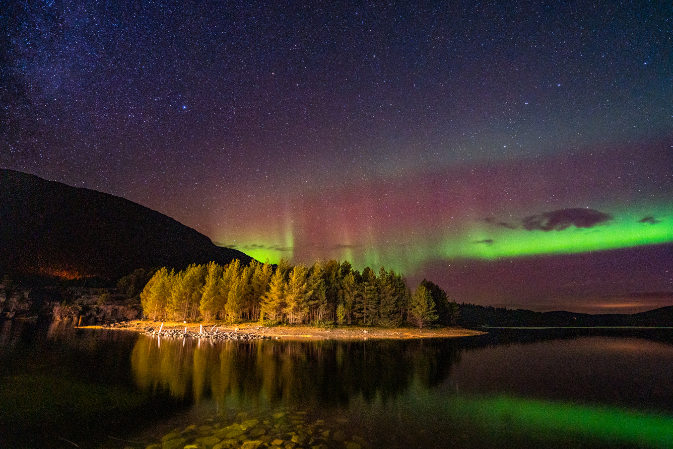
“This is the famous Atlantic Road,” I say enthusiastically as we come across the narrow national road 64 shortly after the town of Kristiansund. Although this road, which is one of the Norwegian Scenic Routes, is off our route, we were promised several times that the 200-kilometer detour was absolutely worth it. “It doesn’t look as spectacular as I thought,” says Tanja, disappointed at first. “The most interesting section is just over 8 kilometers long and lies between the villages of Kårvåg and Vevang. That must still lie ahead of us,” I reply, eagerly waiting to see if the promises of some Norwegians will come true. And indeed, the road suddenly winds along a man-made embankment with waves lapping to the left and right. It runs over viaducts and seven bridges. A railroad line was planned here at the beginning of the 20th century to connect the islands and archipelago, but these plans were abandoned as early as 1935. The plans were reactivated in 1970 and construction began in 1983, costing around 12 million euros. During the six-year construction period under sometimes extreme conditions, the workers had to survive a total of twelve hurricanes.
“Fabulous,” I marvel, driving almost at walking pace so as not to miss anything. Although we take our time, we reach the end of the Atlantic Road, which was declared Norwegian Construction of the Century in 2005, far too quickly. “Let’s go back again,” I suggest. “Sure, the route certainly looks completely different from the opposite direction,” Tanja immediately agrees. “Absolutely, especially if we can find a few good spots to take photos,” I think. As a result, we drive back and forth several times on this extraordinary work of human architecture to take photographs again and again. “No wonder this route is considered one of the most beautiful roads in the world,” says Tanja as we enjoy the sunset over the impressive 260-metre-long Storseisundet Bridge. “What are we going to do now? Do we want to drive on or stay here overnight?” Tanja ponders. It’s already getting dark. I think we should stay here in the parking lot. Since there is no other vehicle and not a single person here, nobody will chase us away”, I say, because overnight stays are not allowed here…