Overlooked by China’s rapid progress
N 37°57'57.8'' E 109°17'04.9''
Date:
16.11.2015 until 17.11.2015
Day: 141-142
Country:
China
Province:
Shaanxi
Location:
Hengshan
Latitude N:
37°57’57.8”
Longitude E:
109°17’04.9”
Daily kilometers:
82 km
Total kilometers:
10,758 km
As the crow flies:
51.43 km
Average speed:
23.6 km
Maximum speed:
44.3 km
Travel time:
3:28 hrs.
Soil condition:
Asphalt
Maximum height:
1.120 m
Total altitude meters:
8.381 m
Altitude meters for the day:
120 m
Sunrise:
07:22 am to 07:23 am
Sunset:
5:31 p.m. to 5:31 p.m.
Temperature day max:
12 °C
Temperature day min:
1 °C
Departure:
10:30 a.m.
Arrival time:
3:30 pm
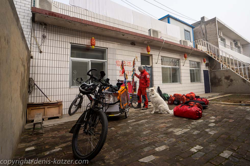
(Photos of the diary entry can be found at the end of the text).
Although the weather forecast has predicted sunshine for today, there is dense fog over Yulin, as there is every day. While Tanja takes Ajaci for her morning ride, I start packing our bikes. I interrupt my work because my smartphone rings. “Yes Tanja? Do you hope everything is okay?” I ask, a little worried because she has only just left. “All clear with us. I just wanted to tell you that you can take your time packing. The fog is much thicker out here on the road than we thought. You can hardly see your hand in front of your eyes. All the cars are driving with their hazard lights on and there’s already been an accident here.” “Okay, I’ll slow down. Thanks for the information.”
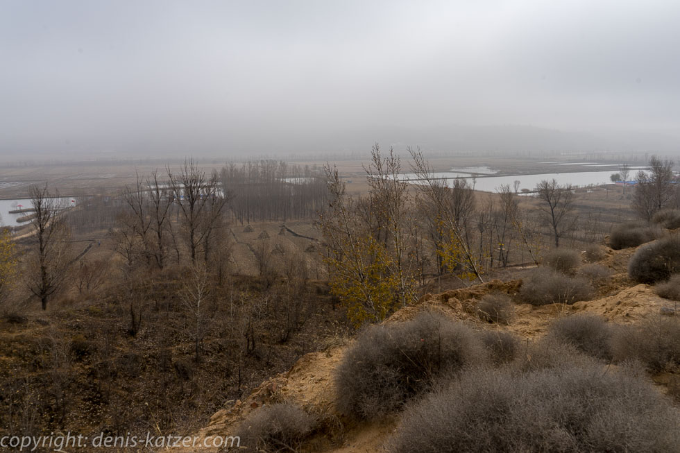
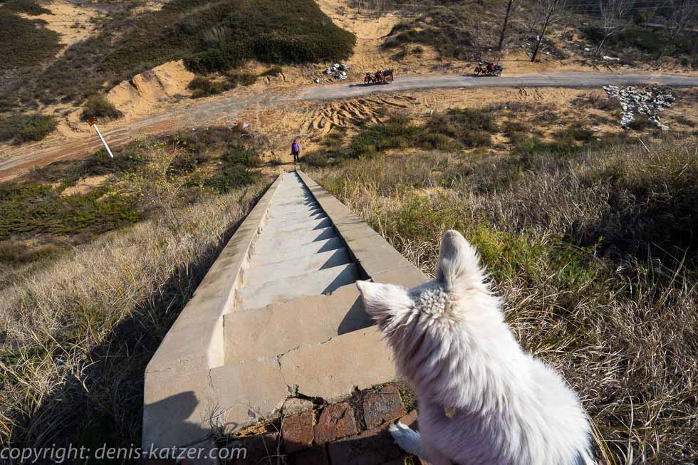
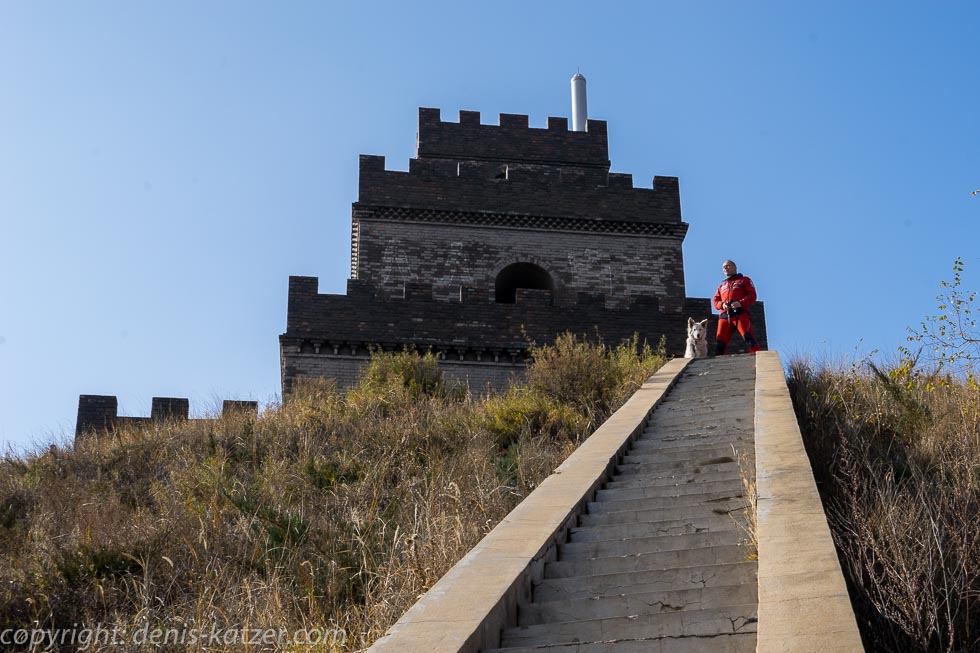
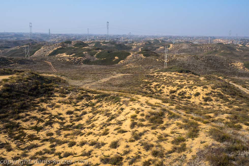
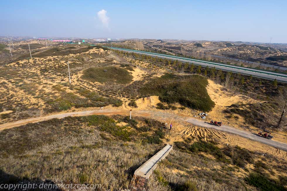
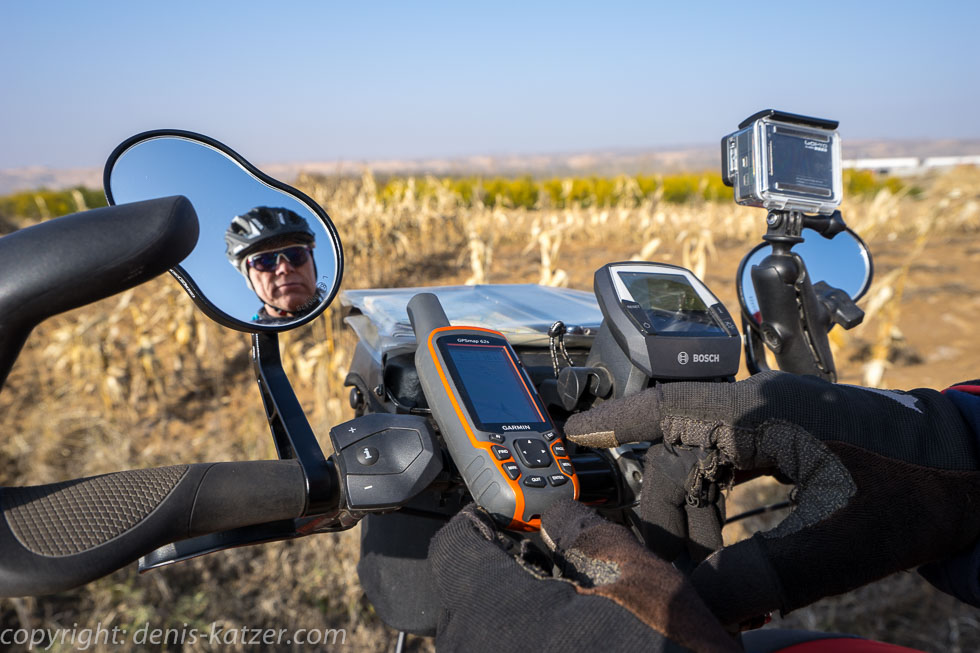
At 10:30 a.m. we venture out onto the road. The fog has lifted a little. The signal lights on our bikes warn drivers. I navigate us through the 3.4 million metropolis in zigzags. Fortunately, I have the new GPS. This makes navigation much easier for me than before. Then Yulin spits us out. We follow a wide road. Hundreds of trucks are waiting on the hard shoulder. Strange, I think to myself, until we come across a road closure sign that directs all traffic to the right. We stop our road trains. The road under construction in front of us cannot be found in MAPS.ME or the GPS. But it leads exactly in the direction we want to go. “If we follow the many trucks, I estimate that we’ll have to take a 20 km detour,” I explain to Tanja. “And if we continue straight ahead?” “Well, that’s the question. The road is closed but we can weave our way through the barrier on our bikes. But it could be that this arterial road ends in no man’s land and forces us to turn back.” “What does your gut say?” “That we should use the new road,” I reply after a while. “So what are we waiting for?” calls Tanja. “Okay, let’s give it a go,” I decide and kick my steed through the barrier. “A dream!” I cheer, gliding along on a brand new, completely empty highway that cuts its way through the middle of the Mu us desert. To our right, the remains of old watchtowers of the Great Wall of China rise up again and again. “Let’s take a break,” I suggest, pointing to a restored watchtower. We park our bikes and climb the stone steps. From up here, there is an impressive panoramic view over the Mu us Desert, which is located in the center of the Ordos Plateau, framed to the north and east by the great arc of the Yellow River. For centuries, the desert was inhabited by nomadic equestrian peoples who led their war campaigns against China from here. The yellow-colored 12 to 15 m high dunes consist mostly of clay and sand. From our eagle’s perspective, we gaze spellbound into the seeming infinity. “You look so thoughtful again. What’s going through your head?” Tanja wants to know. “Oh, I was just thinking about our desert crossing in Australia. Somehow I miss crossing the dunes with our camels, scouting out the ideal line between the sand mountains with binoculars, looking out for waterholes and finding a good camping spot where there’s enough food for our boys,” I say dreamily. “Yes, it was something special to be out and about with our animals.” “Do you miss this way of life?” “Sometimes I do.” “Maybe we should cross Africa on one of our next trips?” I think aloud. “You mean exploring the African continent with camels?” “Yes, why not. It would be a great thing. But it’s an extremely risky adventure because of the incessant wars and unrest.”
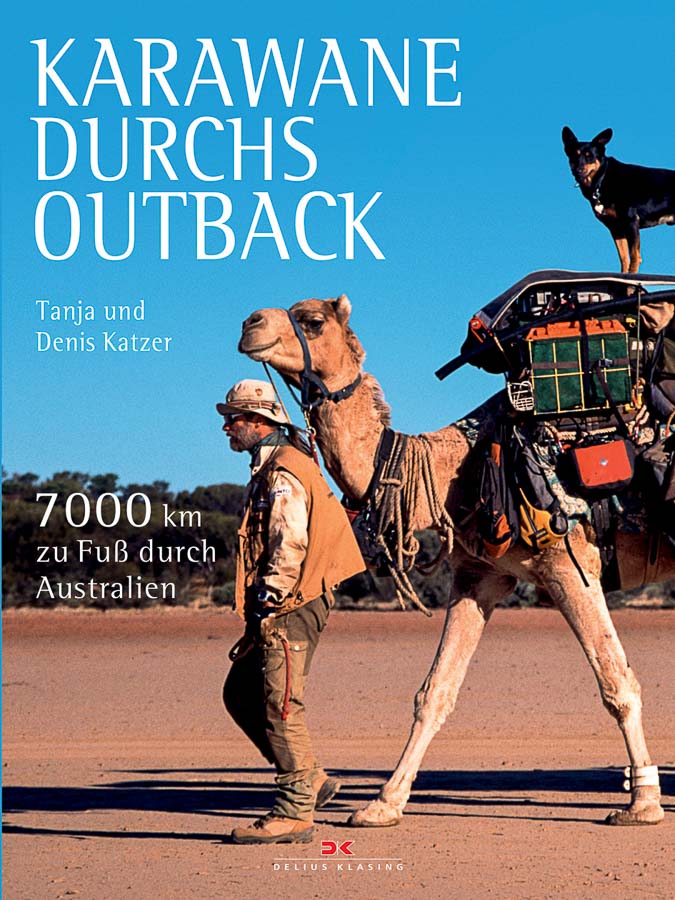
Link to the current Australia book by Tanja & Denis Katzer
Reading sample:
http://www.delius-klasing.de/sixcms/media.php/9/Karawane_durchs_Outback_Leseprobe.pdf
After satisfying our hunger for bicycles with dried bananas and almonds, we continue today’s fantastic ride. “This is what makes cycling fun!” I shout as I make out a large sign, blurry at first, but then quite clearly. This undoubtedly heralds the end of the construction phase. In fact, only a hundred meters further on, the highway is abruptly stopped by the desert. Fortunately, another road crosses the wide carriageway at this point. I ask a few truck drivers who are patching one of the big tires on the side of the road. “Zhe shi ton gang Hengshan de lu ma?” (Is this the road to Hengshan?) “Ongeng?” asks one of the drivers. Although the word has nothing in common with Hengshan, I think for a while and say: “Yes to Ongeng?” “Shide”, (yes) the men answer. We drive on, hoping that Ongeng is Hengshan. “Somehow it sounds similar,” I joke. “Absolutely. I don’t know why you even bother,” laughs Tanja.
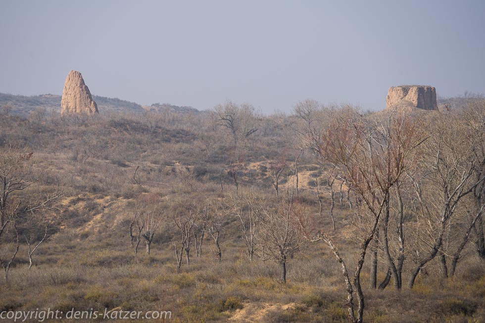
In the afternoon, the sun bites its way through the recurring fog and warms our bodies a little. The terribly bad strip of asphalt winds its way through small villages, where the remains of old fortifications of the Great Wall can be seen again and again. We feel as if we are traveling to a long-forgotten time. A time that was simply overlooked by China’s rapid progress. We bump over the tar that nestles up against a river. Bizarre rock and loess walls rise up to the left and right, around 100 meters high, into which a large number of rock caves were dug in the days when emperors still ruled here. A considerable number of them are still inhabited today. The rugged loess walls have been shaped by the ravages of time, cold and heat, rain and storms. Soon every section of these impressive boundaries of the narrow valley will have its own structure, its own shape. Some of the loess walls bear an astonishing resemblance to the folds of a centenarian’s skin, some look like faces, like the grimaces of mythical creatures. Just a kilometer further on, I think I can see the long fingers of a hand reaching up from the earth’s interior. The rich variety of the constantly changing shapes of the earth is diverse, hard to describe and a great gift for our eyes and soul after the truck madness of the past few days.
After 82 kilometers we reach Hengshan in the afternoon. We quickly found our place to spend the night. As so often, the staff are extremely friendly and help us bring the e-bikes and trailers inside. Once again, our bikes are allowed to spend the night right in the lobby next to the reception desk. Our room is large and, to our delight, odorless. As another day of heavy rain showers is forecast for the region tomorrow, it’s a good place to stay. As I’m lagging behind with my records, I’d like to stay, but the weather forecast promises a few hours of sunshine for the following day. We use it to continue our journey through this idiosyncratic and beautiful landscape…
The live coverage is supported by the companies Gesat GmbH: www.gesat.com and roda computer GmbH www.roda-computer.com The satellite telephone Explorer 300 from Gesat and the rugged notebook Pegasus RP9 from Roda are the pillars of the transmission.