Narrow track – 2.7 billion year old rock
N 68°41'49.3'' E 015°26'49.7''
Date:
05.10.2020
Day: 064
Country:
Norway
Location:
Sortland
Daily kilometers:
100 km
Total kilometers:
5607 km
Soil condition:
Asphalt / unpaved
Bridge crossings:
5
Sunrise:
07:19
Sunset:
18:14
Temperature day max:
14°
Night temperature min:
9°
Departure:
12:00 noon
Arrival:
16:00
(Photos of the diary entry can be found at the end of the text).
Click here for the podcasts!
Link to the current itinerary
(For more posts click on one of the flags in the map)
“And how does it look?” asks Tanja, yawning like a little lion. “What does what look like?” “Well, the weather.” “It looks good. The dark clouds from last night have cleared. We’re in for a wonderful day of travel,” I say and leave the Terra to check the gas tank. “Shit, the tank is almost empty! I hope there’s an LPG filling station in the town of Sortland,” I shout. “Does that mean we can’t cook and heat any more?” Tanja’s voice rings out through a tilted window. “It should be enough for today, but if we don’t find an LPG filling station, we’ll be cooking cold food by tomorrow at the latest.” “Or we can cook over a campfire,” we hear again through the crack in the window. “Just like in the Australian outback,” I reply with a laugh.
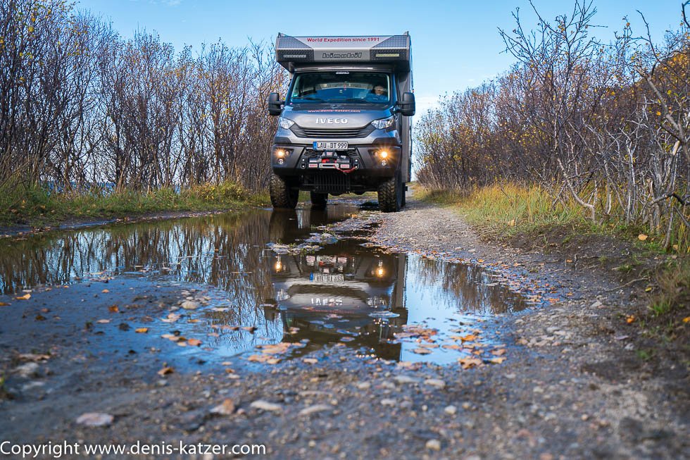
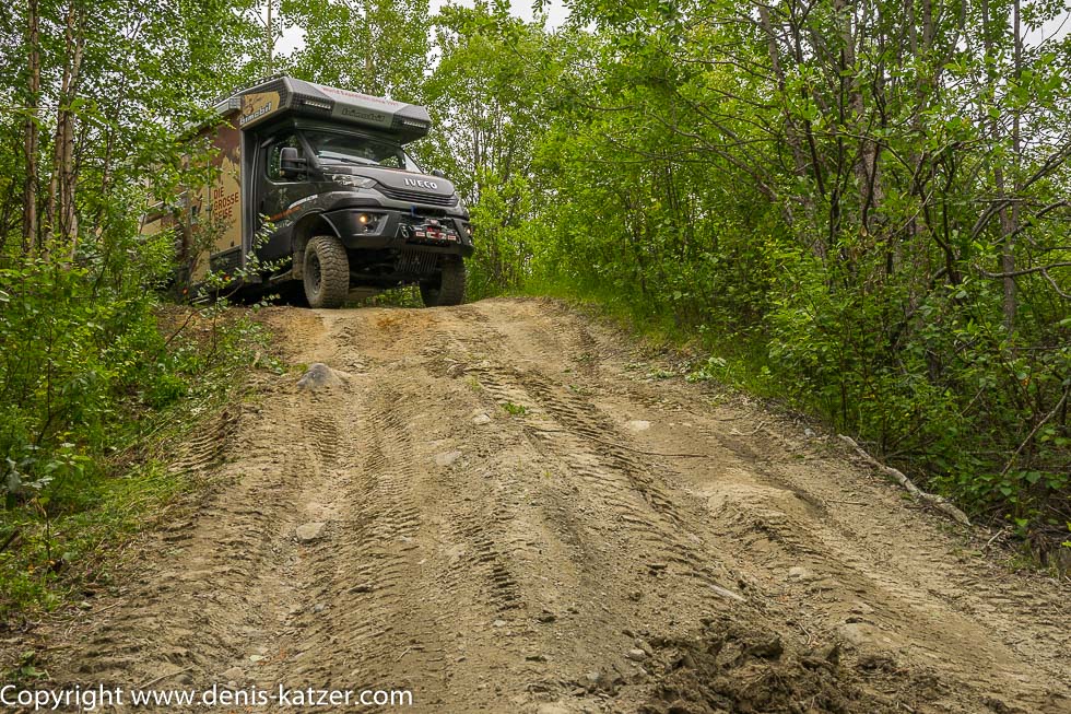
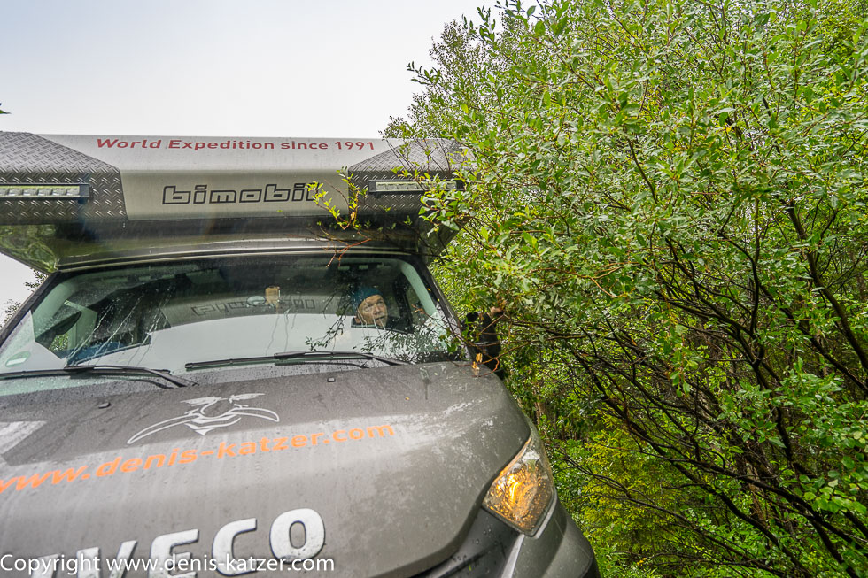
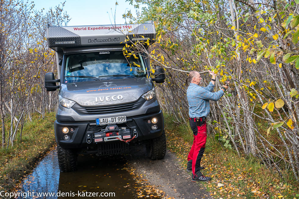
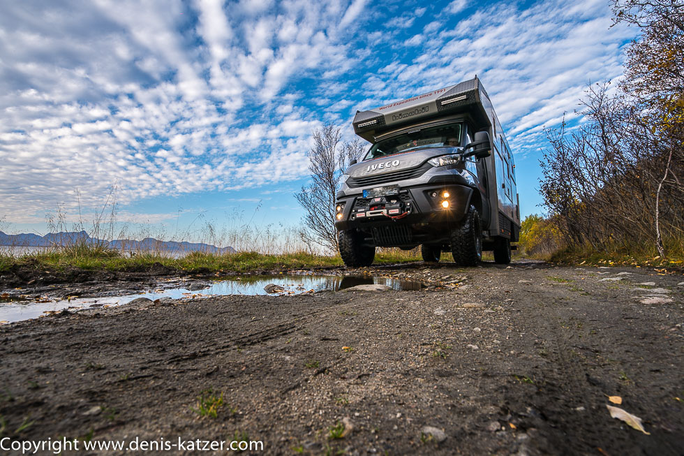
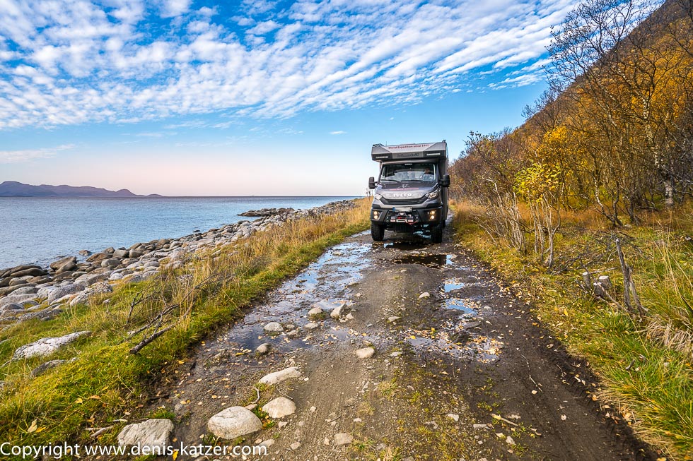
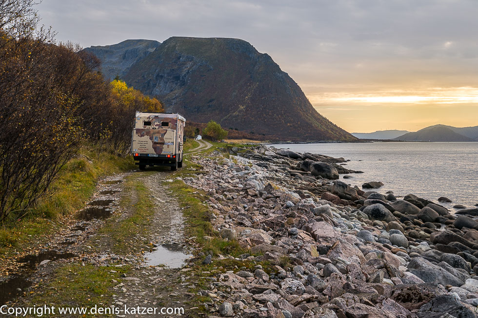
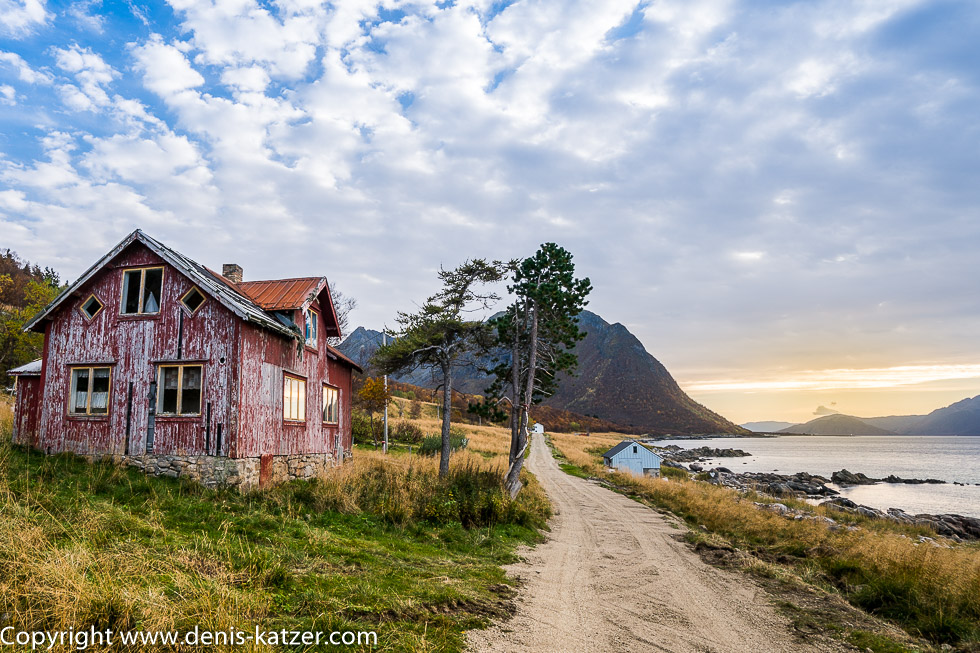
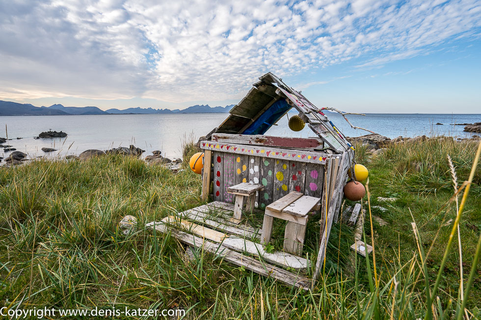
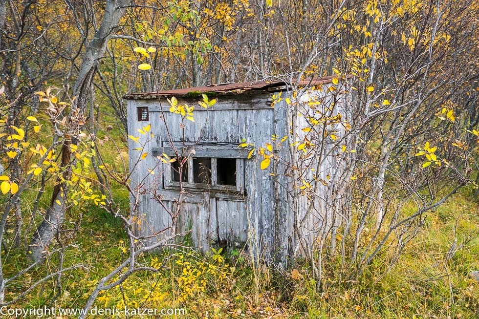
Before we set off on today’s route, I walk around the Terra once, as I do before every start, to check that all the windows, flaps and doors are closed. After my brief check, I climb into the driver’s cab with euphoric anticipation, as I do almost every day. “Ready?” I ask, starting the engine. “Done,” answers Tanja. “All cupboards and doors closed?” “Yeap,” I hear an equally cheerful voice. “Let’s see what today’s off-road route has in store for us. I’m really looking forward to it,” I say, engaging the off-road reduction and first gear and steering our mobile home onto the track, which according to the map is called Fv975. “It’s getting tight,” says Tanja a few hundred meters further on, as the bushes and trees stretch their branches into the path and squeak unpleasantly alongside the cabin. “Crap! Maybe we should have stayed on the tarmac road after all,” I think as thin trees suddenly lean over the path. “Will we get through?” I ask, driving at walking pace under the canopy of leaves. “It looks good on my side, but it’s getting tight up ahead. It’s best if I get out and have a look from the outside,” Tanja suggests, grabs a walkie-talkie and climbs out of the driver’s cab. “Stooop!” I hear Tanja’s warning call just 50 meters further on. “What’s wrong?” “The branch on the left is in front of the roof of the driver’s cab. It’s best if you get out and have a look for yourself.” “I’ll have to saw it off,” I decide a little later and grab the small handsaw that I’ve stowed in the cab since our trip to Russia. Over the next hundred meters I am forced to get out again and again and saw off undergrowth and branches hanging in the way. Water-filled holes, rough stones and branches make our progress slow. “If it stays like this for the next 50 kilometers, we’ll need days,” I curse, having decided to take this route. “You wanted a bit of adventure and when Mother Nature gives it to you, you swear.” “I’m not swearing, I’m just swearing a little,” I justify myself. Suddenly, the forest recedes to reveal a view of a strait, on the other shore of which the mountains of Norway’s third-largest island, Langøya, stretch out into a cloud-covered sky. “It’s beautiful here,” Tanja enthuses. “Beautiful and very lonely,” I confirm, carefully steering the Terra along the bumpy path. To our right, we are separated from the sea by rocks polished by the ravages of time and oversized pebbles. Barely visible tiny waves ripple on the peaceful gulf, over which the clouds break a little, allowing the sun to send a few pink rays down to us. The rough surface of the barely used path gives way to a man-made gravel track. An abandoned wooden house appears on our left. The red paint with which the former inhabitants painted their home many years ago has been almost completely eroded away by the harsh weather of northern Norway. Under the remains of the red tin roof, shreds of insulation flutter in the light wind. With a little imagination, you might think that an old woman is waving to us up there under the roof. I stop briefly to take a photo. As I approach, I notice that the once beautiful little house is built on a stone base. In many parts of Vesterålen, the bedrock is part of the earth’s primary rock and is over 600 million years old. In the municipality of Bø on the island of Langøya to the west of us, one of the oldest rocks in the world was even found, formed 2.7 billion years ago by volcanic activity. “Did the builder of the house know what geological sensation he was building his home on?” I ask as we continue our interesting journey. More and more half-ruined wooden huts or huts gnawed away by wind and weather bear witness to the fact that this region was once inhabited. A small wooden hut, recently painted with yellow, red, green and white dots, crouches directly on the stony bank. Obviously it serves as an adventure playground for children during the summer months…